Jarlhettur mountain ridge
- Einar Páll Svavarsson

- Apr 29, 2022
- 2 min read
Updated: Apr 6, 2025

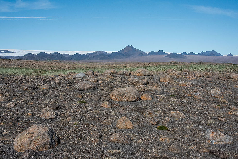
The mountain ridge Jarlhettur (The Earls Cap) is easily visible in southern Iceland from many places and many angles. The ridge is 15 kilometers in length and comprises 20 mountains where each peak is similar to the next, although the height and diameter differ. It is a spectacular sight that can be seen while driving the Golden Circle, with the ice cap Langjökull glacier in the background. The ridge direction is the same as most geological fissures in the area, and in Iceland for that matter—from southwest to northeast. The best visibility is toward the east side, where you have the glacier Langjökull in the background—a perspective that always interests photographers. It is almost odd to find the name Earl in the Icelandic landscape since Iceland hardly ever had any real Earls governing the land or the people. On the other hand, Icelandic Vikings traveled a lot to Europe and were acquainted with Earls and Kings.

Jarlhettur mountain ridge is in contrast with many natural wonders in Iceland:

The mountains are of palagonite nature and almost entirely lack vegetation. The lakes and small rivers at the bottom of the mountains contain glacial waters, so everything is gray and looks like another planet. This contrast with many of the magnificent natural beauties in Icelandic nature makes Jarlhettur ridge fascinating. Most of the mountains are around 800 to 900 meters high, but the highest one, Tröllhetta or Troll Cap, is a little less than 1100 meters. Most of the mountains are barely climbable as the surface of the steep palagonite mountains is made of small rocks. However, those who dare and succeed to climb enjoy a spectacular view.
Access to the breathtaking view of Jarlhettur requires an excellent 4x4 vehicle:

There are mainly two ways to see Jarlhettur in proximity. One is to drive from Þingvellir National Park, located north on the road Uxahryggjavegur (Road Nr. 550), and turn on the rugged mountain road Skjaldbreiðarvegur (F338). On the second part of this drive, a few kilometers before you reach Kjalvegur, you will have an excellent view of Jarlhettur in the north. The second way to reach the proximity of Tröllhetta is to visit the Nýifoss waterfall and Hagavatn. You can take this drive from near Gullfoss waterfall and a short drive on Kjalvegur.


Comments