Search Results
310 results found with an empty search
- Gígjökull glacier tongue development in times of global warming
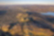
Gígjökull glacier tongue in July 2024 Admission to Gígjökull is free Visitors to Gígjökull are not required to make any payment for entry. Despite the limited capacity of the parking area, it generally accommodates the number of visitors adequately without reaching full capacity. Restrooms and sanitary facilities are not provided at this natural attraction. Gígjökull stands proudly as a steep glacier tongue within Iceland's Eyjafjallajökull ice cap, reaching an impressive height of 1610 meters (5200 feet). Despite its source not being at the peak but rather in a crater nearby, this renowned glacier remains a captivating marvel of nature in Iceland. Over the centuries, decades, and years, Gígjökull has undergone significant transformations, drawing considerable attention in the modern era due to its retreat, often cited as a clear sign of global warming. While global warming has played a role in the glacier's changes, the eruption in Eyjafjallajökull in 2010 emerged as a dominant force in recent times. On a broader scale, natural climate cycles have also influenced Gígjökull's evolution. Nonetheless, this majestic wonder evolves rapidly before our very eyes, contrasting with other natural wonders that remain largely unchanged throughout a lifetime. Gígjökull glacier tongue in 2004 The mesmerizing flow of the ice river I first visited Gígjökull in 1974, and since then, I have returned many times, as it lies along the route to one of my most cherished destinations in Iceland, the Þórsmörk valley. Back then, it was a grand and expansive glacier tongue slowly descending the steep slope from the summit of Eyjafjallajökull. More than a century earlier, over numerous decades, Gígjökull had advanced, leaving behind the characteristic moraines on either side. By 1974, a small lagoon had formed at the tongue's edge. The tongue underwent a noticeable retreat from that point until the 2010 eruption, causing the lagoon to expand. Following the eruption and the massive flood resulting from the magma melting a significant portion of the glacier, which cascaded down and under Gígjökull, the lagoon vanished. Additionally, the eruption carried a substantial section of the tongue towards the Markarfljót river, which flowed towards the ocean, where the ice eventually melted. Gígjökull glacier tongue retreating big time in summer of 2020 The powerful forces of glacial movement are evident in the case of Eyjafjallajökull Like any glacier, its slow advance exerts immense pressure, capable of displacing anything in its path. An example of this relentless force is the recovery of a plane that crashed near the glacier's summit in 1952, only to be discovered at the glacier's base in 1995. This phenomenon illustrates how objects deposited on the glacier's surface will eventually reach its lower reaches within a span of 40 to 50 years. Eyjafjallajökull's abundant precipitation ensures a constant replenishment of snow at its peak, a process that takes approximately half a century for the snow to make its way down to the glacier's terminus. Gígjökull glacier tongue during the Eyjafjallajökull eruption in 2010 A beautiful oasis nestled in the heart of nature's wonders Gígjökull captivates visitors with its serene charm and breathtaking landscapes. In July of 2024, I embarked on a photographic journey to explore the enchanting beauty of Gígjökull and its surrounding area. As I ventured into this picturesque location, I was immediately struck by the fascinating transformation that had taken place over time. The small valley, once a tranquil lagoon, now teems with life as it is dotted with small ponds and lush vegetation. The remnants of the glacial lagoon have given way to a thriving ecosystem, where delicate creeks and spring water meander through the landscape, creating a sense of tranquility and abundance. The juxtaposition of the glacier's imposing presence against the backdrop of this flourishing oasis is a sight to behold. As I observed the glacier, I couldn't help but notice the significant changes it had undergone. Its icy facade bore the marks of time and transformation, a testament to the ever-evolving nature of our environment. The interplay between the glacier's stoic beauty and the vibrant life that now thrives in its wake is a poignant reminder of the delicate balance that exists in the natural world. The photo taken in July 2024 reveals a clear sign of advance compared to the photo from 2020 above The phenomenon of glacier retreat reversing into advancement amidst global warming has been observed In contrast to images captured in 2020, recent observations reveal an advancement of the glacier tongue, marking a notable deviation from the prevalent narrative of glacier retreats serving as evidence of climate change. Notably, Gígjökull, a substantial glacier, has exhibited signs of advancement in 2024. One potential rationale behind this shift could be attributed to the refilling of the crater that had previously depleted of ice in 2010, now poised to supply fresh ice to the glacier tongue. Gígjökull, known for its susceptibility to climatic variations, has historically displayed rapid transitions between advancement and retreat. Information to read before renting a car in Iceland How to visit Gígjökull Finding Gígjökull is easy by taking Road Nr. 1 to Road Nr. 249, which leads to Seljalandsfoss waterfall. The challenging Mountain Road Nr. 249 starts after Seljalandsfoss, becoming rugged after 8 kilometers. Crossing streams and rivers, the route is suitable only for large 4X4 vehicles due to changing conditions. Driving in a small car is dangerous; consider a bus or tour company for a safer journey. Location of Gígjökull on the map of Iceland
- Grænavatn lake Reykjanes Peninsula
Grænavatn Lake at Reykjanes Peninsula Iceland Admission to Grænavatn Lake is free Visitors to Grænavatn Lake are not required to make any payment for entry. Despite the limited capacity of the parking area, it generally accommodates the number of visitors adequately without reaching full capacity. Restrooms and sanitary facilities are not provided at this natural attraction. Located just a short distance south of the Geothermal area Seltún at Krísuvík, Grænavatn (Greenlake) is a fascinating natural wonder waiting to be explored. This small lake, nestled within a volcanic crater, stands out for its striking green hue, a result of the high sulfur content present in its waters. Measuring only a few hundred meters in diameter, Grænavatn provides an enchanting setting for a leisurely stroll, with a well-defined trail that encircles the lake in just about 20 minutes. Despite its modest size, the lake boasts a surprising depth of 45 meters, offering a glimpse into the geological forces that shaped its formation. Standing at the edge of the crater, visitors can witness the color gradient along the shoreline, a visual testament to the lake's depth variations. Geologists regard Grænavatn as a remarkable geological anomaly in Iceland, highlighting its significance as a natural phenomenon worth studying and admiring. The juxtaposition of vibrant green waters against the rugged volcanic landscape creates a captivating scene that showcases the dynamic forces at play beneath the Earth's surface. As visitors explore this unique site, they can immerse themselves in the wonders of Icelandic geology and gain a deeper appreciation for the intricate processes that have shaped the country's diverse landscapes. Grænavatn lake is at Reykjanes Peninsula Iceland A failed venture at Grænavatn that almost destroyed the lake Grænavatn lake Many visitors are curious about the two silage towers and the deteriorating cowhouse near the lake. This project was one of those unfortunate endeavors launched at a time when understanding of nature was limited, and economic interests often overshadowed respect for natural wonders. Although it took place in the 1950s, not that long ago, the project nearly destroyed the lake as some of its surroundings were altered. Needless to say, the venture failed, and those responsible, including the Hafnarfjörður municipality, have yet to remove this unsightly structure and restore the area around the lake. Grænavatn and folklore Grænavatn lake (Greenlake) Reykjanes Because of its unique characteristics and color, the lake has inspired folklore tales for centuries. It wasn't until the mid-16th century that an unusual creature was reportedly seen emerging from the lake. The lake is located near the main road Krísuvíkurvegur (42) and is visible just a few hundred meters from Seltún, the geothermal area. If you're planning to tour Iceland in a rental car , make sure to read this article about the type of car that would be best for your trip. Location of Grænavatn crater Reykjanes Peninsula on the map of Iceland
- Þjófafoss waterfall in the river Þjórsá
Þjófafoss waterfall when the river Þjórsá is in full force Admission to Þjófafoss waterfall is free Visitors to Þjófafoss waterfall are not required to make any payment for entry. Despite the limited capacity of the parking area, it generally accommodates the number of visitors adequately without reaching full capacity. Regrettably, restroom and sanitary facilities are not provided at this natural attraction. The majestic Þjófafoss waterfall is an integral part of the Þjórsá river, which spans from the Icelandic Highland to the southern shore in the Southern Region of Iceland. This river holds the distinction of being the longest in Iceland, stretching 230 kilometers from its northernmost source at Bergvatnskvísl in Srengisandur. Legend has it that the waterfall acquired its name from a grim practice in Iceland's old judiciary system, where thieves were cast into its depths to serve their sentences, never to be seen again. Nestled south of the picturesque Búrfell mountain, the Þjórsá river is like a "tamed beast," its flow meticulously regulated by Landsvirkjun, Iceland's primary electricity producer. Consequently, there are times when the river's flow is controlled to the extent that the mighty waterfall almost vanishes, a phenomenon that might have been a relief to some of the long-lost criminals condemned to its waters many years ago. Þjófafoss waterfall is in the South Region on the map of Iceland I recommend the south side The breathtaking Þjófafoss waterfall offers a unique experience that can be accessed from both the north and south sides. However, the southern side provides a more convenient and awe-inspiring view of the cascading waters. The picturesque backdrop of the majestic mountain Búrefell enhances the beauty of the waterfall, making it a perfect setting for photography enthusiasts seeking to capture the essence of nature's grandeur. Important information regarding renting a car in Iceland article One important factor to consider when planning a visit to Þjófafoss is the timing. It is crucial to ensure that the waterfall is not being utilized by the power company, as this can affect the volume and flow of the water, ultimately impacting the overall visual appeal of the site. By choosing the right moment to visit, visitors can witness the waterfall in its full splendor, allowing them to appreciate the natural beauty and tranquility of this remarkable location. Exploring Þjófafoss from the south side not only offers a more accessible and impressive view but also provides a unique perspective that highlights the rugged beauty of the Icelandic landscape. Whether you are a nature lover, a photography enthusiast, or simply seeking a peaceful escape into the heart of Iceland's wilderness, Þjófafoss promises an unforgettable experience that captures the raw power and beauty of one of nature's most spectacular creations. Access is quite easy Þjófafoss waterfall has a beutiful lava around it If you are driving on the Ring Road Nr. 1 in the southern region of Iceland, you take a turn on Landvegur Road Nr. 26 between Selfoss town and the village of Hella. You drive approximately 45 kilometers north, and you will see a sign for Þjófafoss waterfall. The drive to the parking lot by the waterfall is about 4 kilometers. Þjófafoss in winter with the volcano Hekla in the background Iceland has so many waterfalls that you could easily travel the whole country for summer and only photograph waterfalls. You would never run out of motives as you can always find one more waterfall. Some of the waterfalls are well-known and advertised. One of them is Þjófafoss or the "waterfall of thieves." Allegedly the waterfall got its name from the judiciary system in old Iceland, as thieves were thrown into the waterfall to finish their sentence. The waterfall is in the river Þjórsá south of the beautiful mountain Búrfell. The river is a tamed beast as the water flow is controlled and supervised by Landsvirkjun, the main producer of electricity in Iceland. As a consequence, sometimes the river dries up, and the mighty waterfall almost disappears. A bit strange, but would probably have been welcomed by some of the criminals who were thrown into the waterfall ages ago. Location of Þjófafosss waterfall on the map of Iceland
- Ásbyrgi canyon, camping and hiking
Admission to Ásbyrgi is free Visitors to Ásbyrgi are not obligated to pay an entrance fee. Despite the many visitors, adequate parking space is available for all vehicles. Restrooms and sanitary facilities are accessible at Ásbyrgi camping site and service center, and usage is complimentary. Ásbyrgi Canyon is a great place to visit and a great caping site The canyon Ásbyrgi, in the northeastern part of Iceland, is a joy to behold and a pleasure to visit. Although it is a separate part of the nearby canyon Jökulsárgljúfur, it is considered, geologically, to be a part of Jökulsárgljúfur and formed by the same catastrophic floods and eruptions more than two thousand years ago. Ásbyrgi and the forces of nature The whole area is a monument to the enormous forces of flowing water created when a large eruption occurs under a glacier. What makes Ásbyrgi unique today is the fact that it is shaped like a horseshoe and surrounded by 90- to 100-meter-high cliffs on all except the northern side. This side is also where you enter Ásbyrgi and where the cliffs descend towards the lowland and the shoreline. In the middle is a cliff island of the same height, simply called ‘the island’, that helps emphasize the horseshoe form of the three-and-a-half by one kilometer canyon. Map of Iceland north east region Ws Ásbyrgi made by Odin’s horse Sleipnir? View over Ásbyrgi from Eyjan Even though there are geological explanations, there is also an explanation found in folklore, namely, that the canyon was formed by Sleipnir, the eight-legged horse owned by the god Óðinn (Odin). At one point in time, Odin traveled and came to Iceland, and the horse sunk one of its hooves into the earth and formed Ásbyrgi. Since this story has become widespread knowledge in Iceland, it is often thought that the event was documented in the stories of Norse mythology written hundreds of years before anyone started writing about geology and geography. However, it was regrettably never mentioned in the writings of our beloved 12th-century poet Snorri Sturluson, who wrote much of what we know about Norse mythology. Instead, the story probably came about in a poem by Einar Benediktsson, a 20th-century poet and entrepreneur, published in 1925 called ‘A Summer Morning in Ásbyrgi’. Don't be surprised if you meet many people in Iceland who prefer this explanation about the formation of Ásbyrgi over the scientific version offered by geologists. Beautiful vegetation in Ásbyrgi that offers tranquility Ásbyrgi canyon in Iceland A small pond called Botnstjörn, surrounded by vegetation and astonishing cliffs, is found at the bottom of the horseshoe canyon. It is a beautiful place to visit. The canyon has an unusual variety of vegetation and lively birdlife during the summer. Ásbyrgi is a great place to stay for a day or two and walk some of the convenient and mellow hiking trails. There are hiking trails inside the canyon, up to the top of the cliffs and even to Vesturdalur and Hljóðaklettar if you have a day to spare. An evening walk up to the island, Eyjan, is a very rewarding hike. A view from the south end cliff at Ásbyrgi Canyon Hiking in Ásbyrgi has big rewards The surrounding cliffs in Ásbyrgi give the place a wonderful feeling of a peaceful sanctuary as they often provide shelter from the southern winds. In Ásbyrgi, you will also find one of the best campsites in Iceland. It is a great place to stay for a few days to explore and experience the north-eastern region of Iceland. Today, Ásbyrgi, as well as the whole area of Jökulsárgljúfur canyon, is part of the Vatnajokull National Park and is managed by the park authorities. Part of the Jökulsárgljúfur canyon are the magnificent waterfalls Dettifoss, Hafragilsfoss, and Selfoss. From Ásbyrgi, you can also visit the remote villages of Raufarhöfn and Þórshöfn in the northeast as well as do some whale watching at Húsavík village nearby. All are interesting places to visit. Ásbyrgi camping is a place to stay on your visit to Iceland Ásbyrgi view from hiking trail towards the north Even though it is found at a considerable distance from the Ring Road or Road 1 in Iceland, Ásbyrgi is easily accessible. It is located in the northeastern part of Iceland and is connected to the Ring Road by Road 862, the same road that takes you to the west side of Jökulsárgljúfur canyon and the main viewing panel, Dettifoss waterfall. At the end of that road, you take a right turn onto Road 85 and you can't miss Ásbyrgi. You can also drive to Húsavík town to access Ásbyrgi from the west side at Tjörnes peninsula on Road 85. What to know before renting a car in Iceland. Location of Ásbyrgi on the map of Iceland
- Hólmatungur in Jökulsárgljúfur canyon
Hólmatungur in Jökulsárgljúfur canyon north east region Iceland Admission to Hólmatungur is free Visitors hiking to Hólmatungur are not required to make any payment for entry or at the parking lot. Hólmatungur is a fascinating part of the canyon Jökulsárgljúfur in the northeast region of Iceland. If there is still a hidden gem in Iceland, Hólmatungur is probably the place that fits that description. It is an eight-kilometer stretch situated at the west side of a small valley that is cut through the middle by the mighty glacial river Jökulsá á Fjöllum, just a few kilometers north of Dettifoss waterfall. For most people who visit Hólmatungur, it is one of the island's most peaceful places, with an almost dreamlike quality. Like many places in Iceland, it is a product of powerful geological forces that have swept through and molded the area over thousands of years, often originating in the fearsome volcano Bárðabunga in the Vatnajökull ice cap. For the moment, however, with most of these forces absent, Hólmatungur has developed into a beautiful oasis. Iceland North East Region Hólmatungur is a small gallery of natural wonders Beautiful landscape in Hólmatungur Jökulsárgljúfur Located within the Vatnajökull National Park, Hólmatungur has many elements that contribute to its identity and classification as a natural wonder: Abundant vegetation composed of small trees and a variety of interesting flowers that spread color from the bottom of the canyon up to the hills on the west side of the valley; beautiful small waterfalls that are fed by crystal clear spring-fed streams; and spring bubbles that form a series of short brooks, twisting, turning, and cascading as they find their way to the bottom of the canyon to join the mighty, murky glacial river. What to know before renting a car in Iceland. Amid it all, magical rock formations of small hills, stacks, and ledges decorated with mysterious basalt columns. In addition, many species of birds fly through this natural wonder, singing to celebrate its beauty. It is a geological marvel and gallery of natural spectacles that Mother Nature has decided to display for the few who visit Hólmatungur. Hólmatungur hiking Basalt column in Hólmatungur Hólmatungur is strictly a hiking trail, as it is only accessible by foot. Years ago, when I visited Hólmatungur for the first time, we drove through the area on a dirt road in a 1969 Ford Bronco. That road was closed in the nineties and was moved a few kilometers up the hill to the west. The good news is that the hiking trail from the parking lot at Ytra Þórunnarfjall to Vesturdalur valley through Hólmatungur is one of Iceland's most beautiful hiking trails. It will be worth your while to take a day off from driving the Ring Road to hike along the trail and have a picnic at Hólmatungur. It would be a day well spent. Dark folklore In essence, Hólmatungur is strictly a hiking trail Like many locations in Iceland, Hólmatungur is steeped in folklore. A rather grim story involves Þórunn the Rich, a female farmer from the nearby farm Ás in Kelduhverfi, who once resided in Hólmatungur with her servants. They relocated there to find refuge during an epidemic in Iceland in the late 16th century. They managed to live relatively comfortably in Hólmatungur until their food supplies dwindled. Having already slaughtered all the sheep and other domestic animals, and with no news about the plague, Þórunn resorted to slaughtering and cooking the sheepherder for sustenance. After he was prepared, she insisted on taking the first bite to assess its quality. After chewing for a few minutes, she spat it out, declaring it tasted awful and was poisonous, and decided to return to the farm. The real reason, however, was that Þórunn, being quite plump, feared she might be the next to be eaten. This truth was only revealed years later on her deathbed, where she confessed that the sheepherder was the most delicious meat she had ever tasted. Finding your way to Hólmatungur Hólmatungur has many elements that contribute to its identity and classification as a natural wonder On the Ring Road , you need to drive north onto Road no. 862, and about a kilometer further than the turn to the Dettifoss parking lot, you turn east on Road no. 887. You drive to a hill and parking lot named after our female farmer, Þórunn. This is where you also find the hiking trail, but make sure you are on the lookout for Þórunn as she has been seen wandering the hills looking for the leftovers of the delicious sheepherder. It is also essential to note that this hike is only possible during June through September. Location of Hólmatungur on the map of Iceland
- 10 most interesting Landscapes natural wonders in Iceland
Visit the Natural Wonders Iceland is truly an extraordinary destination, famous for its abundance of natural wonders all situated in one area. The unmatched variety and beauty of these wonders provide a unique experience for every traveler. Additionally, the compact nature of Iceland's landscape adds to its allure, allowing visitors to conveniently explore numerous natural attractions in a short time. Mt. Dyrfjöll and Stórurð The ease of exploring Iceland to see its natural wonders is unmatched. In contrast to other places where such marvels are spread over large areas, demanding significant travel and exploration, Iceland provides a compact display of nature's beauty. The accessibility of these attractions, ranging from stunning waterfalls to magnificent canyons and impressive glaciers, highlights the island's geographical abundance. Iceland is all about the Natural wonders Each natural wonder in Iceland demands its own time for appreciation. Whether it's the tranquil beauty of a cascading waterfall, the grandeur of a deep canyon, or the majesty of a glacier tongue, every sight invites visitors to pause, absorb, and immerse themselves in its magnificence. The experience of witnessing these wonders can be truly transformative, leaving a lasting impression that is often once-in-a-lifetime. Seljalandsfoss you can walk behind Photography enthusiasts, in particular, will find themselves captivated by Iceland's natural beauty, spending hours capturing the perfect shot. The allure of the landscapes and the play of light create a visual feast that is irresistible to anyone behind the lens. In such moments, time seems to stand still as you strive to encapsulate the essence of these natural wonders through your camera. In conclusion, Iceland offers a treasure trove of natural wonders that are best explored at a leisurely pace, allowing for a deep connection with the environment. By immersing yourself in the beauty of Iceland's landscapes and skipping artificial imitations, you can truly appreciate the raw, unspoiled magnificence that this small island in the Atlantic Ocean has to offer. Interesting lava formation at Skælingar And most significantly, Iceland’s distance from most of Europe and North America is much shorter than many think. Most of Europe and the east coast of North America are only a three to five-hour flight away. You can fly here from California, Oregon, or British Columbia in seven and a half to eight and a half hours. If you look at our list below and the accompanying photos, you might understand why so many people have Iceland on their bucket list. For a week or a ten-day family summer vacation , it is probably one of the most spectacular places you can visit. The ten natural wonders you can experience in Iceland are so amazing that you will probably book a road trip or vacation tour to our country before you finish this article. 1 - Waterfalls are the most interesting thing to do in Iceland One of many spectacular waterfalls in Iceland, Dynjandi Iceland has infinite waterfalls; more than 1600 of them are estimated to be higher than 2 meters. Our waterfalls cover a broad spectrum: we have small but attractive waterfalls like Háifoss and Dettifoss , one of Europe's largest waterfalls. If you travel the Ring Road , you can visit three to five stunning waterfalls merely by stepping out of the car, and each and everyone will take your breath away. Among our most interesting waterfalls are Goðafoss , Gullfoss , Dynjandi , and Seljalandsfoss . 2 - Iceberg lagoons is another great thing to do in Iceland Fjallsárlón glacier and iceberg lagoon An iceberg lagoon is a rare but spectacular natural wonder, the product of a glacier tongue and a lake. When ice from a glacier starts its journey down a mountain slope traveling at a very slow speed, it forms a glacier tongue, usually a long and cold one. At the end of the tongue, the iceberg falls and begins floating on a lake or a lagoon. Seeing this up close is entirely different from seeing it in a photo or a video. Most people are surprised by the magnitude of their feelings when they see this astonishing natural wonder. Iceland has two beautiful iceberg lagoons by the Ring Road: Jökulsárlón and Fjallsárlón . 3 - Hot springs and geothermal activity is a another thing to do in Iceland Geothermal activity in Hveradalir in the Highland in Iceland Seeing steam and boiling mud bubble up from the ground in a geothermal area is a magnificent experience. Moreover, the eruption of Strokkur in the Geysir area to a height of 20 meters is a very rare sight. It is like seeing up close in real life something that you thought was special effects made on a computer. There are geothermal areas in most parts of Iceland. Among the most popular are Seltún in the Reykjanes Peninsula, Geysir in Haukadalur, Hveradalir in Kerlingafjöll, and Námaskarð near Mývatn. 4 - Glaciers and glacier tongues a must to do in Iceland Svínafellsjökull glacier toungue Glaciers are a large part of the Icelandic landscape. Iceland has five large glaciers, one of them the largest in Europe. Most house some of the most notorious volcanos on our planet; the weight of the glaciers prevents the magma from bursting to the surface. This is one reason Iceland is often called the land of ice and fire. When traveling in some regions, glaciers are visible for hours—in some interesting places, they are even accessible from the Ring Road. The largest glacier/icecap is Vatnajökull, a relatively easily accessible one is Langjökull, and probably the most famous (although the smallest of the five) is Eyjafjallajokull . 5 - Canyons a great thing to do in Iceland Jökulsárgljúfur canyon Although our largest canyon Skaftárgljúfur (25 kilometers), disappeared when it was filled with lava in the late 18th-century Skaftáreldar eruption, Iceland still has many spectacular canyons. Some are natural wonders by their own merit and also house other stunning natural wonders. The sight from above and within a canyon is beautiful and breathtaking. Iceland's most spectacular canyon is Jökulsárgljúfur Canyon ; other sensational ones include Eldgjá in the Highland and the newly discovered Stuðlagil in the Eastern Region. 6 - Aurora Borealis - Northern lights - to do in Iceland Northern lights at the Jökulsárlón glacier lagoon in November For those who have never experienced strong and fast-moving northern lights, the first sight could be almost frightening. The scene of the dark sky lit up in neon green, red, violet, and orange, moving like a supernatural force, is simply out of this world, like a major movie special effect multiplied by 100. During the winter months (October through February), the beautiful and powerful northern lights can be seen in many places in Iceland. Our experience is that the small town of Fáskrúðsfjörður in the Eastern Region and Akureyri in the north are the best places to experience the Aurora Borealis on an otherworldly or extratextual level. But here you can read about the best time to see the northern lights in Iceland . 7 - Basalt columns the best place to see is in Iceland Basalt columns rock formation at Kálfshamarsvík The rocks, cliffs, and stacks made of basalt columns are sometimes so uniform that it is hard to believe that they have not been designed and constructed by humans. Sometimes these geological formations are almost poetic, bending and swaying around other parts of the landscape or by a riverside. Some of the most spectacular basalt column sites in Iceland are in popular destinations like Reynisfjara . Others are in Stuðlagil , Dverghamrar , Gerðuberg , and Kálfhamarsvík . All have distinct shapes and forms. 8 - Geothermal pools a unique thing to do in Iceland Strútslaug geothermal pool in the Highaland The idea of tearing off your clothes in the middle of a spectacular, grand landscape and diving into a natural pool made of warm groundwater is undoubtedly irresistible. There are so many natural pools in Iceland that one can plan a two-week visit and bathe in a different natural pool every day. Although many such pools are accessible from the road, like in the Westfjords, the most interesting ones, like Landmannalaugar , Hveravellir , and Laugarvellir (that also has a warm shower), are in the Highland. 9 - Rhyolite mountains are a unique thing to do in Iceland Colorful Rhyolite mountains in Landmannalaugar If there is a place on Earth where nature celebrates color, it must be the rhyolite mountains. If you are used to seeing only two colors on mountains—one when in proximity and one when far away—prepare yourself. The rhyolite mountains have many different colors splashed all over a spectacular cluster of peaks. There are many such mountains in Iceland, and all of them are extremely interesting and colorful. Two of the most interesting are Landmannalaugar and Ljósártungur in the Icelandic Highland. 10 - Animals in their natural environment - a great thing to do in Iceland Humpback whale breaching If you have never seen a 16-ton humpback breach whale, a flock of puffins meeting on the edge of a cliff, a seal relaxing by the shore, or other free animals in their natural environment, you are in for a treat. There are many ways to watch birds, whales, seals, and other animals in Iceland. Most interestingly, they can be seen when viewing other natural wonders or traveling the island. The most interesting place to see whales is the world capital of whale watching, Húsavík . There are also many places where you can see puffins during summer; one of our favorites is Papey in the Eastern Region. Gullfoss waterfall in Iceland Discovering Iceland's mesmerizing terrains is an unparalleled adventure. From the rough lava fields narrating tales of past eruptions to the enigmatic caves sculpted by nature's might across centuries, every part of this nation showcases the unrefined magnificence and strength of the Earth. The majestic mountains act as quiet sentinels, while the winding rivers carve their paths through the landscape, molding the terrain in their wake. The landscape is marked by craters and calderas, serving as reminders of the powerful forces simmering below the surface, poised to unleash their strength. The dormant and active volcanoes contribute a blend of danger and awe to the surroundings, with their majestic peaks reaching towards the sky, showcasing nature's might. What to know before renting a car in Iceland. The serene lakes reflect the surrounding beauty, offering moments of tranquility amidst the rugged terrain. The black beaches, with their volcanic sands, are a stark contrast to the icy glaciers that hide ancient ice caves within their depths. The spring-fed creeks babble merrily through the land, providing a lifeline to the diverse flora and fauna that call this place home. The sea stacks rise defiantly from the ocean, weathered by the relentless waves that have shaped them over time. The fjords cut deep into the land, creating sheltered harbors for ships and adding a sense of grandeur to the coastal landscape. The valleys and coves offer hidden treasures waiting to be discovered, each with its own unique charm and beauty. Lóndrangar So, while I could go on and on about these wonders of Iceland, I leave you with a taste of the magic that awaits you in this land of fire and ice. But remember, there is so much more to discover, so I encourage you to delve deeper into the wonders of this incredible country by exploring the other treasures that await you on my website.
- Sveinstindur mountain
Admission to Sveinstindur is free Visitors to Sveinstindur are not required to make any payment for entry. Despite the limited capacity of the parking area, it generally accommodates the number of visitors adequately without reaching full capacity. Restrooms and sanitary facilities are provided free of charge at a campsite close to this natural attraction. The best short hike and view in the Highland in Iceland The magnificent Sveinstindur mountain, with its imposing height of 1093 meters (3930 feet), is a true marvel of nature that proudly overlooks the stunning Langisjór lake in the heart of Iceland's Highland. This majestic peak stands out among its neighboring mountains, creating a commanding presence in the landscape. Situated at a base elevation of around 350 meters (1150 feet) and with Langisjór Lake peacefully resting at 670 meters (2198 feet) above sea level, Sveinstindur offers a spectacular vantage point that is truly awe-inspiring. Standing on top of Sveinstindur looking east to Vatnajökull ice cap The endless horizons Visitors to Sveinstindur Mountain are treated to a breathtaking panoramic view that is unparalleled in its beauty and grandeur. From this elevated vantage point, one can witness the splendor of six glaciers, majestic volcanoes, a myriad of mountains, winding rivers, and endless horizons that seem to stretch infinitely in every direction. The sheer vastness and diversity of the landscape visible from Sveinstindur make it a destination that captivates the senses and leaves a lasting impression on all who have the privilege of experiencing it. Hiking up to the top of Sveinstindur You need to walk up to the top To truly grasp the magnitude of the natural wonders that unfold before your eyes from the summit of Sveinstindur Mountain, one must witness this extraordinary vista firsthand. The ever-changing light and shadows that dance across the landscape, the crisp mountain air that invigorates the senses, and the sense of peace and tranquility that envelops you in this pristine wilderness all combine to create a truly unforgettable experience. Sveinstindur Mountain stands as a testament to the raw beauty and untamed wilderness of Iceland, inviting visitors to immerse themselves in the splendor of nature at its most majestic. Map of Highland in Iceland The path to the top is not difficult Photography from Sveinstindur mountain The walking trail near the service center by Langisjór is not only somewhat steep but also provides breathtaking views that make each step worthwhile. Although the trail is roughly a kilometer long and takes about an hour and a half to finish, the elevation gain of around 400 meters ensures a fulfilling climb. For those who are afraid of heights, especially near the top, the view might be intimidating, but the scenery is truly spectacular, even if you only walk the first 150 meters. As you ascend, you'll enjoy stunning vistas to the west, south, and north. At the summit, the view expands to the east, revealing iconic Icelandic landmarks like Hvannadalshnúkur, Lakagígar, and Laki, which commemorate the historic volcanic eruption of 1783. Remember that the experience can vary significantly with the weather, as calm winds offer a more peaceful journey compared to windy days. Exploring this part of Iceland, the Highland, is possible only from mid-July to mid-September, highlighting the importance of considering weather and season when planning your visit. Sveinstindur and Langisjór are part of the Fjallabak Nyrðri drive: The view from Sveinstindur is sprctacular The drive to Sveinstindur goes through a highland road. It is meant only for good 4X4 vehicles as it is a challenging dirt road with many creeks and rivers to cross. Anyone who takes a small car to the Highland, even a small 4X4 vehicle, is taking a significant risk of damaging the car and adding a considerable cost to the tour. Now, coming to Langisjór, when you are on the Nyrðri Fjallabak road, you take a turn on Langisjór (F235) and drive the road to the service center by the lake. Sveinstindur hike If you're planning to tour Iceland in a rental car , make sure to read this article about the type of car that would be best for your trip. Location of Mt. Sveinstindur on the map of Iceland
- Foss the waterfall at Síða farm by the Ring Road
Admission to Foss á Síðu is free Visitors to Foss á Síðu are not required to make any payment for entry. Despite the limited capacity of the parking area, it generally accommodates the number of visitors adequately without reaching full capacity. Regrettably, restroom and sanitary facilities are not provided at this natural attraction. The waterfall Foss á Síðu is visable from the Ring Road Foss á Síðu, also known as the Waterfall at Síða, is a charming farm nestled along the iconic Ring Road in Iceland's Southern Region. Situated about 10 kilometers to the east of the quaint village of Kirkjubæjarklaustur, this picturesque location captivates visitors with its breathtaking scenery and tranquil ambiance. The farm's most striking feature is the small waterfall that cascades gracefully from the majestic cliffs, adorned with delicate moss vegetation that adds a touch of natural beauty to the landscape. The harmonious blend of the cascading water, lush greenery, and rugged cliffs creates a scene that can only be described as a masterpiece crafted by nature's own hand. As visitors stand in awe of this serene setting, they are reminded of the raw power and beauty that the Icelandic landscape has to offer, making Foss á Síðu a must-see destination for anyone exploring this mesmerizing country. Foss á Síðu waterfall is in the South Region on the Map of Iceland Foss is mentioned in the Book of Settlement Wind affecting the waterfall Foss á Síðu The farm is referenced in the Book of Settlement, indicating its presence since the settlement of Iceland in the 9th century. Situated in front of breathtaking cliffs with a charming small waterfall, it is difficult to overlook. The farm is named after the waterfall, which originates from a lake called Þórutjörn at the top of the cliffs. A steep walking path beside the waterfall allows access to the cliffs, and the hike is worthwhile. The view from the top is magnificent. Despite the waterfall's modest water flow, it remains one of the most photographed waterfalls in Iceland. What to know before renting a car in Iceland. The blown-away waterfall Foss á Síðu seen from Dverghamrar small basalt column cliffs Sometimes the waterfall is blown away by heavy winds when a limited amount of water is coming from the lake. According to a local folklore story, a rare kind of ghost wanders around the area around the farm Foss and the nearby farm Hörgsland. The ghost is a dog whose name is Móri, or simply Ghost, who carries a curse directed at a particular family in the 16th century. The curse was set out to last for nine generations. There are those that argue that the curse has finished its course and Móri has disappeared forever, but not all. Throughout the centuries, Móri has never done any harm to people outside this unfortunate family. Location of Foss á Síðu waterfall on the Iceland map
- Saxhóll crater Snæfellsnes Peninsula
The Snæfellsnes Peninsula is home to a variety of captivating sites to explore. Upon entering the Peninsula from the town of Borgarnes, one of the first recommendable destinations is Eldborg Crater. The hike to the top of Eldborg typically takes between two to two and a half hours to complete a round trip from the parking area. Saxhóll crater at Snæfellsnes Peninsula Exploring Saxhóll Crater: A Brief Excursion For those seeking a shorter excursion, Saxhóll Crater presents a more accessible alternative. Although not as grand as Eldborg, Saxhóll features two craters, with the lower crater being the more popular and accessible to climb. Historically, Saxhóll was once the site of a farm and a church estate; the church was dissolved in the mid-sixteenth century, but the farm remained in operation until the early 19th century. Few remnants of the farm and church remain, although the craters persist. The two notable craters in the Saxhóll area are Litli Saxhóll (Little Saxhóll) at 109 meters and Stóri Saxhóll (Big Saxhóll) at 125 meters. What to know before renting a car in Iceland. Saxhóll the view and the crater Recently, a convenient walking path with steps has been established, making climbing easy. It is one of the most accessible sites in Iceland for viewing a crater that once erupted magma at temperatures around a thousand degrees, creating the extensive surrounding lava fields. The walk from the ground level to the top of the crater is only 40 meters. Plus, there is a beautiful staircase consisting of approximately 400 steps. Standing on top of Saxhóll crater Unveiling the Spectacular Views from Saxhóll Crater: A Window into Iceland's Volcanic Landscape At 125 meters above sea level, the view from the top is truly spectacular for such an easy hike. On a clear day, you can see the lava fields around the crater, the magnificent Snæfellsjökull glacier, the adjacent mountains and ridges, and even the Atlantic Ocean. This makes visiting Saxhóll Crater a great opportunity to explore volcanic activity in Iceland and appreciate how eruptions have shaped the landscape. The Rich History of Saxhóll: From Farm to Fishing Station Saxhóll has a longstanding history as both a farm and a fishing station. The craters in this region have existed for thousands of years, providing a backdrop to the area's rich history. Settlement in this land began around the year 950, with Saxi, the son of Álfarinn, relocating to Iceland during this period in search of improved living conditions. From the summit of Saxhóll, it may seem improbable that agricultural practices were once conducted in the vicinity of the crater; however, there are indeed small areas suitable for cultivation nearby. Additionally, the coastline offers viable fishing grounds, and the abundant avian population contributes both meat and eggs to the local diet. Historically, the region surrounding Saxhóll, especially along the shore, was home to various farms and fishing stations. Nevertheless, the northern tip of the Snæfellsnes Peninsula has remained relatively isolated and remote throughout the centuries. Due to complicated communication channels, few individuals needed to visit this locale. Notably, several centuries ago, a church was situated near Saxhóll, supporting a modest community that persevered in the face of isolation. Steps and stairway up to Saxhóll crater Discover the Scenic Drive Around Snæfellsjökull Glacier Several years back, the road was upgraded, and now there is an asphalt road encircling the Snæfellsjökull glacier area, making it easily accessible. This route has become one of Iceland's most popular scenic drives. To get to Saxhóll, follow the main road that loops around the tip of the Snæfellsnes Peninsula, called Útnesvegur (Nr. 574) in Icelandic. Saxhóll is situated just a few meters from the road at its westernmost point. Location of Saxhóll on the map of Iceland
- Lakagígar Craters and Mt. Laki 4x4 self-drive and Skaftáreldar eruption information
Admission to Lakagígar is free Visitors to Lakagígar are not obligated to pay an entrance fee. Adequate parking is available for all vehicles. Restrooms and sanitary facilities are accessible at the service center by Mt. Laki, and their use is complimentary. Rangers working at Laki provide good information about hiking, geography, geology, and the surrounding area. A view to the west part of Lakagígar craters Lakagígar Craters is a row of volcanic craters that stretches for 25 kilometers and is located close to the western side of the Vatnajökull glacier in the Icelandic Highland. These craters were formed in 1783 during one of the largest eruptions on our planet in historical times, Skaftáreldar. The eruption had catastrophic consequences for the people of Iceland. Tens of thousands of livestock were killed, and over ten thousand individuals, around 25% of the population at that time, lost their lives. This time was extremely difficult for Iceland, and it also affected people in many other countries. The Skaftáreldar eruption is believed to have killed more people worldwide than any other eruption in historical times. Some historians have even suggested that Skaftáreldar triggered the French Revolution, leading to crop failure in France, which worsened the already dire situation. It is considered the most extensive volcanic activity on the planet in the last 1000 years, and the lava that flowed from the craters covered nearly 600 square kilometers of land. Today, one can even drive through the lava on road nr. 1, which is 40 kilometers south of the main craters, when heading east to the small village of Kirkjubæjarklaustur coming from Reykjavík. Even the well-known Eyjafjallajökull eruption and the recent small eruptions at the Reykjanes Peninsula are insignificant compared to the consequences of Skaftáreldar. Therefore, Lakagígar is more than just a natural wonder. It is also a historical site and a large-scale monument showcasing the power and consequences of Mother Nature. A drive to Lakagígar is an adventure. Map of Icelandic Highland The drive to Mt. Laki and Lakagígar is a 4X4 mountain dirt road Map of the track to Lakagígar and Laki 4x4 drive The site where the craters and Mt Laki are located north of the south region in Iceland can only be accessed from late June until the beginning of October since it is situated in the Highland. To reach the destination, you will need to drive approximately 40 kilometers (25 miles) north of Ring Road Nr. 1 on a rough dirt road that includes two fords in unbridged rivers to cross and a few smaller ones crossing small creeks. Please note that you will need a good 4X4 vehicle and proper preparation to make the trip. It is essential to remember that all roads that require driving across rivers can be hazardous. The volume of water can change quickly if there are changes in the weather, so exercise caution. I have driven this road hundreds of times in all seasons and I am also a highly experienced highland and 4X4 driver, so I am asking you to keep mind that this is a mountain road with creeks and rivers. I have often seen conditions change dramatically in a few hours. Crossing the river Varmá at Úlfarsdalur The drive to Lakagígar and Laki from road nr. 1 is a scenic one, as the elevation gradually increases and reaches up to 900 meters (2900 feet). About halfway on the road to Lakagígar it is a good idea to stop by the beautiful waterfall Fagrifoss. It is beautiful waterfall and fits well to stretch your legs and take a pause from the driving. When you continue, the drive becomes even more rewarding after crossing the ford on the river Hellisá. It's no wonder that this drive to Laki and Lakagígar is becoming one of the main attractions in the Icelandic Highland. A view from the top of Mt. Laki to the east Despite the rough road, the scenery and the craters are captivating. The drive also requires patience as the average driving speed on the mountain road is around 30 kilometers per hour (19 miles per hour) for 40 kilometers (25 miles). To begin your drive to Lakagígar, turn north on Ring Road Nr. 1 on the south shore a short distance west of the small village of Kirkjubæjarklaustur. Turn to Holtsvegur (Road 206) after driving just two kilometers past the farm Hunkubakkar. After that, turn north again on Lakavegur Highland and Mountain Road F206. Follow the road for 40 kilometers (25 miles), and you will reach Mt. Laki and Lakagígar craters. The hike up to Mt. Laki for a grand view of the Lakagígar craters The service center at Lakagígar When you reach Lakagígar Craters, park your car in the parking lot located by the small Vatnajökull National Park service center. From there, take a short hike up to the top of Mt. Laki - a small mountain standing at approximately 820 meters high above sea level. The elevation of the hike is only 200 meters. Before June 8, 1783, Laki was just an ordinary, lonely, and peaceful mountain. However, everything changed when two large volcanic fissures opened on the west and east sides of the mountain, causing an unprecedented amount of highly toxic magma to the surface. Although the mountain was relatively unchanged, the eruption ripped Laki's northeastern side apart, leaving some interesting cracks in that part. It is a fascinating spot to visit when hiking the mountain. From the top you can see the craters, both to the east in direction and into Vatnajökull glacier and the craters to the west, towards Skaftá river. It is an astonishing view. Hike up to the top of Mt. Laki Despite widespread writings and sometimes misinformation, Laki had nothing to do with the Skaftáreldar eruption. However, when people visited the source of the catastrophic events after things cooled down in 1784, they named the craters on both sides after Laki, calling them the Laki craters. The trail is relatively easy and highly rewarding, as the view from the top of Laki is stunning and excellent in every direction. Drive the F207 and explore Laki, the Highland and the lava Exploring the Highland in Iceland at Lakagígar craters If you're looking to explore the Highland, renting a good and solid 4X4 car can be an advantage. You can then drive the F207 road and experience a magnificent circle in the lava and witness some truly magical landscapes. On that dirt road there is yet another ford to cross. This road begins from the Laki service center and goes by the Tjarnargígur crater, which has a small lake, Úlfarsdalur small valley, and the river Skaftá. The drive is a wonderful experience as you travel through the Lakagígar lava, the silence that is created by the moss, the many craters, the beautiful oasis in Úlfarsdalur, and the many pseudo craters at the junction to Hrossatungur. What to know before renting a car in Iceland. Moreover, the F207 mountain road not only complements the Lakagígar drive but also elevates the experience to new heights. The drive takes about an hour and a half and ends by joining the F206 close to the Hellisá ford. Alternatively, you can stop at the Blágil camping site, which is also close to the Hellisá ford and have dinner or enjoy the Highland night and camp overnight. Blágil is an excellent camping site, and the hut is quite lovely for accommodation in the Highland. I have camped there many times and can give it a high recommendation. From Hellisá river, you can drive the same way back to Road Nr. 1. One of the more interesting craters at Lakagígar - Tjarnargígur Although an enormous area of land glowed with lava flow and threatened life with toxic chemicals in the air only about 230 years ago, the Skaftáreldar eruption also formed a breathtaking landscape. The activity was such that enormous carpets of lava flowed on both sides of the mountains, all the way to shore. On the west side, the lava filled the (then) largest canyon in Iceland, which was 25-kilometer long and has now disappeared under the lava. The whole event changed a large area of the landscape forever. Lakagígar craters The drive to Lakagígar is a scenic journey through Iceland's rugged landscapes, passing by stunning vistas of volcanic terrain and lush greenery. As you make your way to this remote destination, you will come across the breathtaking Fagrifoss waterfall, a hidden gem cascading down a rocky cliff, adding to the enchanting allure of the area. Upon reaching Laki, the hike to the top offers a challenging yet rewarding experience, with panoramic views stretching as far as the eye can see toward glaciers, mountain ridges, and lava fields. The vista from the summit is a true feast for the senses, showcasing the raw beauty of Iceland's untouched wilderness. Exploring Tjarnargígur provides a glimpse into the region's geological wonders, with unique rock formations and otherworldly landscapes that transport you to a different realm. Finally, a visit to the tranquil oasis at Úlfarsdalur offers a serene escape from the hustle and bustle of everyday life, allowing you to immerse yourself in the peace and tranquility of nature. These experiences encapsulate the essence of Iceland's unparalleled beauty and charm, offering a rare opportunity to connect with the country's natural wonders in a way that few have the chance to experience. Lakagígar stands as a testament to Iceland's unique and captivating allure, beckoning travelers to discover its hidden treasures and forge unforgettable memories in this extraordinary land. Location of Laki and Lakagígar on the map of Iceland
- Búðir and the black church at Snæfellsnes Peninsula
The little black church at Búðir Snæfellsnes Peninsula Búðir is primarily recognized for its iconic black church, constructed in 1850. However, the region has a rich history that predates the church. For many centuries, Búðir served as a vital trading post and fishing station on the southern part of the Snæfellsnes Peninsula, playing a significant role in local commerce and trade. The area also held some administrative functions during this time. Most of the activity was concentrated in the surrounding regions to the south and northeast of Búðir. Unfortunately, at the end of the eighteenth century, a devastating flood destroyed many of the houses and left the hamlet in ruins. Subsequently, development shifted to the site where the church and the hotel are located today. The lava field Búðahraun From the church you can see Búðaklettur crater (left hill). Búðir has never been a suitable area for farming or cultivation, primarily due to the presence of Búðahraun, a vast lava field located to the west of Búðir. Just one glance at the rugged lava terrain makes it clear that the soil is far from ideal for agriculture. The cove to the east and northeast of the church, formed by the mouth of a few small rivers, served as an excellent landing spot for fishing boats and trading vessels. Throughout history, particularly during the settlement era and up until the late 18th century, Búðir was a significant fishing station and trading hub. However, after a major flood, its prominence declined, leaving only the church, a place for lodging, and some minor commercial activities. In recent times, as local residents and tourists from around the globe began to explore the Snæfellsnes Peninsula, the charming little black church drew their attention, breathing new life into the area. The little black church at Búðir The view to Snæfellsjökull glacier For many visitors, the sight of a black church standing by the shoreline is a compelling reason to stop by. Originally constructed in 1850, the church was initiated by Steinunn Sveinsdóttir, who carefully preserved sacred items from a small turf church that was dismantled at the close of the 18th century. Remarkably, some of these items are still housed in the current church, which continues to serve as an active place of worship. Along with the first church, a cemetery was established, as the area was then just barren lava. To create a proper burial ground, the bishop instructed everyone in the parish to transport sand from the shore to fill a large depression for the graves, forming the cemetery that exists today. Over the years since its founding, the little black church has undergone numerous renovations and is now, alongside the cemetery, well-maintained and a delightful place to visit. Th view and the surrounding area at Búðir Búðir and surroundig area A visit to Búðir is not just a journey; it's immersion in the breathtaking natural beauty that defines the area and its stunning surroundings. Upon arriving at the iconic church, you are immediately struck by the remarkable setting of this quaint structure, perched beautifully against the backdrop of untamed nature. Explore the shoreline After parking your vehicle conveniently near the church, take the time to explore the shoreline. A leisurely stroll toward Frambúðir, an old fishing station resting beside a picturesque shelly beach, is a must. This area invites you to soak in the serene coastal atmosphere and perhaps, enjoy a moment of reflection by the water. Hike to Búðaklettur For those seeking a bit of adventure, I highly recommend embarking on a hike to Búðarkelttur via the trail known as Klettsgata. This trail leads to an impressive crater that played a significant role in forming the Búðahraun lava field approximately 5,000 years ago. The hike covers a distance of just 3 kilometers (2 miles) each way, making it a manageable trek that typically takes no longer than two hours to complete. What to know before renting a car in Iceland. Look closer at the lava at Búðir As you navigate the trail, particularly during the summer months, you'll be treated to an astonishing display of diverse plant life, which flourishes in this unique environment. The view that awaits you at the summit of the crater is nothing short of spectacular, offering a panoramic vista that showcases the rugged beauty of the surrounding landscape. The path meanders through the remnants of the ancient lava field, enhancing the sense of wonder as you connect with the geological history of the region. In every sense, Búðir is a remarkable destination that offers both tranquility and adventure, making it an unforgettable place to explore and appreciate the wonders of nature. Location of Búðir on the map of Iceland
- Mt. Kirkjufell and Kirkjufellsfoss waterfall
Kirkjufell mountain close to Grundarfjörður Admission to Kirkjufell is not free Kirkjufell is a spectacular mountain near the town Grundarfjörður at Snæfellsnes Peninsula . In recent years it has become one of the most recognized landmarks and one of the most photographed places in Iceland. Kirkjufell has always been considered a beautiful mountain by Icelanders. But although admired and noticed, it was just another mountain in the past. Still, with growing tourism, social media, and many competent photographers, it has been enhanced to a new level. Kirkjufell and Kirkjufellfoss waterfall The sweeping landscape of Kirkjufell, crowned by the majestic Kirkjufellsfoss waterfalls in the foreground, often graced by the ethereal glow of the northern lights, captivates the imagination and has become iconic across the globe. This stunning mountain truly captured the world's attention when it was featured as a filming location in the acclaimed series Game of Thrones, where it was rebranded as Mt. Arrowhead. As a result, Kirkjufell has emerged as one of Iceland’s most recognizable landmarks, drawing countless travelers eager to witness its breathtaking beauty firsthand. Photography and Kirkjufell Despite its newfound fame and accolades that place it among the most stunning mountains worldwide, one could argue that the mountain’s natural allure was first recognized by adventurous tourists and later celebrated by the show's producers. Prior to this exposure, the enchanting synergy of Kirkjufell and its cascading waterfall remained relatively undiscovered, with few images being captured by Icelandic photographers. It is only through the lens of skilled photographers that the spellbinding union of this iconic waterfall and mountain was revealed to the world, forever transforming how we view and appreciate this remarkable corner of nature. West Region map of Iceland The name Kirkjufell Kirkjufellsfoss waterfall Nestled in an island renowned for its towering mountains, the Icelandic language boasts a rich vocabulary to describe the captivating features sculpted by nature's powerful forces. Take Kirkjufell, for example: while many might simply perceive it as a mountain, its story is far more intricate. In its early days, Kirkjufell was affectionately referred to as Kirkja, which translates to "Church." This name is fitting, as the peak's distinct silhouette strikingly resembles the steeple of a church, exuding an almost divine beauty that captivates all who behold it. What to know before renting a car in Iceland. Kirkjufell name The term "Fell" specifically denotes a small mountain that sits gracefully between a hill and a lofty mountain, often standing isolated in its grandeur. This solitary characteristic is one of Kirkjufell's most notable traits today, enhancing its appeal as a photogenic monument that presents a stunning vista from every angle. Surrounding Kirkjufell, one can find natural wonders like the invigorating Kirkjufellsfoss waterfall, which cascades impressively down the mountainside. Kirkjufell and the town Grundarfjörður Moreover, the enchanting cove Grundarfjörður, located on Kirkjufell's eastern flank, once bore the name Kirkjufjörður, although this name ultimately faded into obscurity. Interestingly, in the 18th century, Danish sailors attempted to rebrand Kirkjufell with the unflattering moniker "Sugartop," yet this name never gained popularity, allowing the majestic Kirkjufell its rightful place in Icelandic heritage and scenery. A difficult and dangerous climb to the top Mt. Kirkjufell from the west side Climbing Kirjufell mountain Kirkjufell is 469 meters high (1538 feet). It is a product of many forms of geology throughout millions of years, which gave it many fascinating installments, one on top of the other. When you stand in front of the mountain, you can sense how difficult it is to climb. The higher you look, the steeper the slopes. Kirkjufell has tempted many people to climb up to its peak throughout the centuries and has also taken many lives in the past and recently. It is a rugged mountain to climb and only for well-trained climbers. It is not recommended to climb but will remain interesting for those who seek adventure and is, of course, for a point of the spectacular view over Breiðafjörður and Snæfellsnes Peninsula from the top. It is highly recommended, for those who are interested, only to climb Kirkjufell with a local guide. And for those interested in hiking, there is a trail around Kirkjufell which takes about three to four hours to hike. How to visit Kirkjufell and Kirkjufellsfoss waterfall? Mt. Kirkjufell from the east side Kirkjufell is on the north side of the beautiful and historically rich Snæfellsnes Peninsula. Kirkjufell and Kirkjufellsfoss waterfall are within walking distance from the small town of Grundarfjörður. It is an inseparable part of the Snæfellsnes Peninsula drive and a must-stop. By the waterfall on the main road Nr. 54 Snæfellsnesvegur is also a good parking lot and walking paths around the waterfall. The walking trail is great, and the whole surrounding by the waterfall is a spectacular place to take photos of Kirkjufell and one of the most scenic places when driving the Snæfellsnes Peninsula. Kirkjufellsfoss waterfall and Mt. Kirkjufell Parking fee at Kirkjufell Please be informed that there is a mandatory entrance fee for visiting Kirkjufell and Kirkjufellsfoss. The minimum cost for entry by an ordinary family car is ISK 1,000 ($6.00) and is collected at the parking lot entrance. The fee is processed through an application provided by Parka, which has received criticism due to its poorly designed user interface. Additionally, your entrance and license plates are monitored by surveillance cameras. Regrettably, despite the collection of relatively high fees, the parking infrastructure, pathways, and information services barely meet expected standards, as no restrooms and sanitary facilities are provided. Location of Kirkjufell on the map of Iceland Ring Road Drive in Iceland