Search Results
310 results found with an empty search
- Fjallsárlón glacier tongue and iceberg lagoon
Fjallsárlón glacier tongue and lagoon One of Iceland's most visited and admired natural wonders is the glacier lagoon Jökulsárlón. It is a lagoon or a lake at the end of a glacier tongue. When the ice breaks from the tongue, it floats on the lake, melts, and finally floats out to the Atlantic Ocean. The location is just perfect on the coastline by the main road circling around the island, Road Nr. 1. This easy access is one of the reasons the lagoon is so popular. You are basically in proximity to astonishing melting icebergs that recently fell from the glacier just by parking your car. Just around the corner by Jökulsárlón, another lagoon, Fjallsárlón is also quite accessible but smaller and not visible from Road Nr. 1. Fjallsárlón is in the South Region on the map of Iceland Although smaller Fjallsárlón has an advantage A spectacular view to the glacier Fjallsárlón Approximately 10 kilometers before you come to Jökulsárlón from the west, there is a turn on your left to Fjallsárlón. A new service center has opened, and you can also take a tour of the lagoon. You can stop by the parking lot by the service center and over a small hill, and you will have the lagoon Fjallsárlón in front of you. As the lagoon is much smaller, you have a better view of the whole lagoon and the edge of the tongue where the icebergs fall into the water. This part of the glacier tongue is very photogenic and adds a perfect background to the lagoon. Access to Fjallsárlón is easy Fjallsjokull glacier tongue by Fjallsárlón lagoon Although not visible from the main Road Nr. 1, often referred to as the Ring Road, Fjallsárlón is practically on the Ring Road. It is about 110 kilometers east of the small village of Kirkjubæjarklaustur. When you stop by the parking lot, you need to walk a short path over the hill north of the parking lot to see the lagoon. If you're planning to tour Iceland in a rental car , make sure to read this article about the type of car that would be best for your trip.
- Skógar hamlet with two waterfalls and a great museum
Old houses that are part of Skógar museum Skógar is a tiny hamlet on the south shore of Iceland, right by the Ring Road. Although best known in Iceland for most of the 20th century for its regional primary and middle school serving the surrounding rural area, today it is mostly recognized for the stunning waterfall Skógafoss. The waterfall is one of the best-known landmarks in Iceland and one of the most visited tourist attractions in the country. Like most district schools, Skógar was also one of the first places in Iceland to offer hotel accommodations for tourists during summer. It was common for the dormitory to be used as a hotel during summer. Like the building at Skógar, the School buildings and dormitory were well-designed and good. It is still a hotel, but now it is all year round as both communication and the educational system have changed in Iceland. Skógar is in the South Region on the Map of Iceland One-of-a-kind museum and another waterfall Skógar museum For many reasons, the small hamlet Skógar and Skógafoss waterfall have developed into a large-scale tourist attraction in Iceland. The whole area is stunning, with the waterfall, green hills, and the glacier in the background. Skógar also has a long history of interest among visitors and tourists, offering accommodation long before others in the rural area in Iceland. The popular hiking trail Fimmvörðuháls, leading between the glaciers Eyjafjallajökull glacier and Mýrdalsjökull glacier to Þórsmörk, starts at Skógar. There is also another waterfall, Kvernufoss, in the neighborhood that is becoming increasingly popular. But last but not least is the Skógar cultural and heritage museum, where you can see local artifacts related to the living conditions in Iceland for many centuries. It is one of the most interesting museums in Iceland and opens all year round. Access to Skógar is as simple as it gets in Iceland Skógar hamlet Skógar and Skógafoss are almost impossible to miss if you are driving on the Ring Road. The waterfall and the hamlet are quite visible from Road Nr. 1. It is located between the village of Hvolsvöllur and Vík at the west end of Sólheimasandur. Anyone visiting Skógar should take the time to visit the Kvernufoss waterfall and the museum. Skógar also has excellent accommodations, a great camping site, and wonderful hiking trails up the hill by Skógarfoss waterfall. Skógar is part of the Ring Road drive in Iceland - read my Ring Road article .
- Stjórnarfoss waterfall
Stjórnarfoss waterfall If you are traveling the Ring Road in Iceland, you are probably interested in all the natural wonders and attractions worth seeing. Since there are many waterfalls in Iceland along the way near the Ring Road, some get more attention than others. Stjórnarfoss waterfall is one of the hidden and seldom visited, although a beautiful place and sight not far from the main road. The waterfall is quite beautiful, and consists of two approximately 15-meter falls on an upper and lower tier. The higher one lives in the shade of the lower one, as it is only visible from quite a distance. The lower one is quite spectacular as it spreads out on, the lower tier. The fall is part of the river Stjórn that originates in the mountain Geirlandshraun near the road to Lakagígar craters and Laki mountain. It is one of the rivers you cross when driving to Laki. Stjórnarfoss is in the South Region on the Map of Iceland A perfect place for picnic and camping The beautiful waterfall Stjórnarfoss If you enjoy the sounds of nature, like the sound of a stream or the sound of water falling down a slope, you should consider visiting Stjórnarfoss. The area around the waterfall is quite scenic, pleasant, and perfect for a picnic. This is a nice stop if you have your own food and snacks on your Ring Road tour. It is also a good place to camp and is usually less crowded than many other camping sites along the southern part of the Ring Road. If you have a tent, it is a great place to overnight if you want the sound of the stream and waterfall to put you to sleep. Easily accessible and near the Ring Road Stjórnarfoss waterfall is easaly accessable You take a turn north on the roundabout when you are on the Ring Road by the small village of Kirkjubæjarklaustur. This turn takes you to Road Nr. 203, Geirland road. You only need to drive about two kilometers to the camping site Kleifar. You have a good parking space here, and it is only a short walk to the waterfall. But once you arrive at the lower tier, you can not see the upper one. If you're planning to tour Iceland in a rental car , make sure to read this article about the type of car that would be best for your trip.
- Downtown Reykjavík City Center - Miðbær district
Reykjavík city center Reykjavik is the birthplace of Iceland. According to written sources from the 13th century, it is the place of settlement of Ingólfur Arnarson, often referred to as the man who found Iceland. Archeological research has confirmed that a Viking village in the ninth century existed where Reykjavík is now. The result of the study can be viewed at an exhibition in Aðalstræti. Reykjavík city on the map of Iceland Reykjavík City Center is also the center of government in Iceland and much more Skólavörðustígur shopping street in the city center in Reykjavík city The Reykjavík city center district is the center of government, culture, and commerce in Iceland. The city center has many government buildings and institutions for the Icelandic government and the city. The most prominent building is, of course, the Icelandic parliament by the tiny park Austurvöllur. A flag is waved on the building when the parliament is in session. When the public is offended, Icelanders flock in front of this building to demonstrate and demand changes. It is, in a way, an icon of our precious democracy. Other impressive buildings are the offices of the prime minister, formerly a prison from the 18th century, the city hall, the main church, and the marvelous modern music and conference hall Harpa with outer walls designed by the Danish / Icelandic artist Ólafur Elíasson. Laugavegur and Skólavörðustígur are two streets you must know and see in Reykjavík city center Harpa conference center in the city center in Reykjavik The city center is crowded with restaurants and coffee houses. At the city pond, the great sculpture “In memory of the anonymous official” by Magnús Tómasson faces The city hall. To the south of the core center and the pound are the main buildings of the University of Iceland. The Reykjavík airport is also in the district of the city center. From the center towards the east is the main shopping street, Laugavegur, initially leading to the hot springs of Laugardalur, where the people in Reykjavík would take the laundry for washing. From Laugavegur is a turn to Skólavörðustígur, leading to the big church, Hallgrímskirkja; on the hill is Skólavörðuholt. The street is the home of fantastic design shops, galleries, cafés, restaurants, small stores, and artist shops. From the tower of the church Hallgrímskrikja, the view is excellent. In front of the church is a statue of Leif the Lucky, the man whom we claim to be the discoverer of America, by the American sculptor Alexander S. Calder. All the old marvelous houses we managed to preserve in the City Center of Reykjavík Residential area in the city center Alongside Laugavegur is Hverfisgata, with the old museums' house, with standing exhibitions of Icelandic culture and the National Theater, an impressive design by Iceland's most prominent architect Guðjón Samúelsson. The city center is also a great place to live; understandably, most of the houses are old since this is the first district built in Reykjavík. Since other districts didn't start to develop until the twenties and the thirties, the district of the city center is the heart of Reykjavík. Bæjarins bestu is a famous hotdog stand in Reykjavík City Center For the residents of the city center, Reykjavík provides good services, like preschool, primary and secondary schools, colleges, and other educational institutions. There is a beautiful old indoor swimming pool built almost a century ago, currently under renovation, with a long-awaited outdoor swimming pool to be added. For people living in the city center, the district is considered the best and most attractive place to live in Iceland today.
- Reykjanes Peninsula drive from Reykjavík
Reykjanes Peninsula has recently had an eruption Reykjanes, or the Reykjanes Peninsula, in southwest Iceland, is one of the most accessible parts of the island all year round. It offers many fascinating natural wonders and, from a geological point of view, is one of the more exciting parts of Iceland. Here, the rift between the two tectonic plates, the North American and Eurasian, comes ashore, and there are two active geothermal areas with hot springs and blowing steam. It is home to various kinds of craters and has a number of large lava fields that surfaced only a few hundred years ago. It is also a place where we had a recent eruption that produced the latest lava field in Iceland, Geldingadalahraun. If you are interested in hiking, the Reykjanes Peninsula also has some spectacular short hiking trails and small mountains to climb and enjoy a beautiful view. The shoreline also offers dramatic cliffs and a view of powerful waves crashing against cliffs and the lava. It is a place of spectacular places, pleasant small towns, villages, and a beautiful scenic drive. Reykjanes Peninsula Least-mentioned in sagas A view from Spákonuvatn lake towards Mt. Keilir In medieval times, Icelandic scholars, monks, and writers wrote sagas of Icelanders — stories about how the settlement of this Nordic island from 870 to 1070 happened about two hundred years earlier. There are about 40 stories, all great epics describing the land, farms, people, their families, life, friendship, and disputes. Most of the regions in Iceland have reasonably detailed documentation of the settlement, except the Reykjanes Peninsula, which is rarely mentioned for a reason. At the time of settlement and until medieval times, the Peninsula had many eruptions that made farming impossible. If there was a farm to grow and harvest in the beginning, it was most likely covered with glowing lava soon after the first settlement. The making of new landscapes Thus, almost no one lived there at that time. Furthermore, most parts of the country are usually packed with small streams, creeks, and rivers, but in the Reykjanes Peninsula, you will only find a few tiny and almost dried-up streams. The peninsula is very porous and leaky; most of the water is groundwater. Large chambers of fresh water can be found more or less under the lava in Reykjanes. Therefore, finding a place for farming and agriculture is challenging. During settlement, it was almost uninhabitable. The many interesting places Seltún geothermal activity Today, conversely, the Reykjanes Peninsula has many exciting qualities and places for visitors. If you are staying in Iceland for a few days or are on a short stopover, visiting the Reykjanes Peninsula is an excellent choice. Driving the circle from Reykjavík to Kleyfarvatn to the tip of the southwest through the charming small village Garður and back to Reykjavík is a grand day tour. Close to Lake Kleyfarvatn , you will find the colorful geothermal area, Seltún , with boiling clay and small, smoking hot springs. Nearby, you can stop at the explosion crater, Grænavant Lake, and Eldborg, which erupted in historic times. From the volcanic footprints, you can stop by the magnificent Krísuvíkurberg cliff to view the many layers of lava molded by the mighty forces of the Atlantic Ocean. On your way to the mysterious Gunnuhver hot spring, you can stop by the lava from the recently erupting volcano at Geldingadalir; you can also dip into the groundwater pumped up by the geothermal power plant at the Blue Lagoon, not to mention the famous bridge between continents where you can walk from the North American tectonic plate to the Eurasian one in only a minute. If you are still game for an adventure after visiting the old lighthouse in Garður, you can stop along the way to Reykjavík and drive the 10-kilometer gravel road to walk through the Lambafellsgjá narrow ravine (not for those of us who are claustrophobic). The peninsula of fishing and fertile fishing grounds Grindavík fishing town and torist service center If you are interested in history, you can also visit Selatangar, a fishing station that started to provide fish and work as early as the 14th century. Like many places that had rich fishing grounds right outside the shore and a good landing place, Selatangar was, at the time, a prominent place to provide food for the islanders. However, probably due to the harsh lava environment, it never became a town or village like some other fishing stations, such as Grindavík, Keflavík, Njarðvík, Hafnir, Garður, and Sandgerði, which developed during the 19th and 20th centuries. These are all interesting small towns and villages to visit on your tour around the Reykjanes Peninsula. The gate to Iceland and the modern-day The bridge between continents Although not mentioned as an exciting place to live early in Icelandic history, the Reykjanes Peninsula became vital around the middle of the 20th century. As the chosen location for the US naval base after WWII, the small, isolated island in the north became a breeding ground for international culture and relations. As the airport grew larger and tourism increased, it also became the gateway to Iceland. Today, it is the home of Iceland’s international airport, where you land if you visit the country. The perfect stopover drive Krísuvíkurberg cliff If you are planning a short visit to Iceland and want to see some fantastic sites and natural wonders without taking a long ride to other regions, you should consider the Reykjanes Peninsula. Even if you are staying for a few days, it is convenient to visit and a good option if you are looking for places to spend a day. It takes less than 40 minutes from Reykjavík, the capital, to start the tour. You can visit most of the areas in the peninsula the whole year round. Along the way, you will also find museums and good restaurants. It is a geological wonderland, a good place for hiking, and a wonderful place to visit a typical Icelandic town or village. If you're planning to tour Iceland in a rental car , make sure to read this article about the type of car that would be best for your trip.
- The Northern Lights in Iceland and the best time to see them ?
Northern Lights, Aurora Borealis, at Jökulsárlón What are the best months or the best time of year for independent travellers to see the Northern Lights in Iceland? Important information for those traveling on their own and in a rent a car The Northern Lights, or the Aurora Borealis, appear regularly in Iceland from the middle of August through to the end of March. Any time outside these months, the Northern Lights do not appear, as the nights are short, and daylight dominates the sky. During these months, the Aurora Borealis appears almost everywhere in the country if the strength, or the Aurora level, is right and the skies are clear. So, you need to visit Iceland during winter to see the Northern Lights. That makes the winter the best season for seeing the Northern Lights in Iceland. But some months rather than others. What are the best months and times in the evening to see the Northern Lights in Iceland? Northern Lights at Reykjanes Peninsula In the months of August and September, nightfall typically descends around 9:00 p.m., enveloping the surroundings in darkness. As the calendar progresses, the onset of darkness advances, commencing at 7:00 p.m. in December and eventually reaching 5:00 p.m. As the winter solstice passes on December 21st, the evenings gradually lengthen until nightfall returns to 9:30 p.m. by March. Mastering the Magic: Chasing the Northern Lights in Iceland I have cultivated a profound fascination for the Aurora Borealis, commonly known as the Northern Lights, and have diligently monitored their forecasts over the past several years. My frequent journeys to various locations in the vicinity of Reykjavík, the capital of Iceland, and throughout the country have been dedicated to capturing the exquisite allure of this natural phenomenon through the lens of my camera. Through my extensive experience, I have found that the window between 9:00 p.m. and midnight presents the optimal opportunity to behold the Northern Lights. More specifically, the timeframe spanning from 9:00 p.m. to 11:30 p.m. is particularly delightful and affords the most breathtaking views. Under favorable conditions, one can almost certainly catch a glimpse of the Northern Lights or, better yet, be treated to a magnificent celestial display during this period. Optimizing Northern Lights Viewing in Iceland For travelers visiting Iceland primarily to witness the Northern Lights, it is advisable to remain awake until 3:00 a.m. to optimize the chances of viewing this natural phenomenon. The likelihood of observing them post-midnight is diminished if the Northern Lights are not visible in the evening despite promising conditions. Does the weather play an important role in the viewing of the Aurora Borealis? Northern Lights, Aurora Borealis, in Reykjavík Iceland A clear sky with a temperature slightly below zero degrees Celsius is the perfect condition to witness the awe-inspiring Northern Lights in all their glory. For photographers and anyone seeking to fully immerse themselves in this breathtaking spectacle, a gentle breeze can elevate the experience, especially when near a tranquil lake where the lights dance upon the water's surface, creating a magical ambiance. Yet, in Iceland, where winter reigns supreme, we must humbly acknowledge that Mother Nature holds the reins when it comes to viewing the Northern Lights. The weather in Iceland between November and February can be harsh, with treacherous road conditions and occasional closures due to heavy snowfall. However, a snowy landscape can actually enhance the enchantment, casting a mesmerizing glow and adding depth to the nighttime vista. If the sky is overcast and gloomy, seeking alternative activities is best, as the Northern Lights remain elusive under such conditions. Moreover, strong winds can intensify the cold, posing a challenge for prolonged outdoor viewing sessions. In such instances, enduring the frigid temperatures for extended periods may prove to be quite demanding. How do we look for the Northern Lights in the sky? Northern Lights, Aurora Boreals, by Djúpavatn Reykjanes Peninsula When you find yourself at your chosen location, eagerly anticipating the appearance of the lights, rest assured that you will not miss the Northern Lights should they grace you with their presence. At times, even with low intensity, you may catch a glimpse of the mesmerizing spectacle. The display typically begins with a faint green hue in the sky, gradually evolving into vibrant neon-green undulating streaks. Occasionally, when the activity is subdued, the Northern Lights manifest as a gentle green mist on the dim horizon. Therefore, the pursuit of the Aurora Borealis demands nothing less than unwavering patience. It is a waiting game that promises a rich reward, for when the lights dance across the sky, the experience is not merely breathtaking but transcendent. Occasionally, the show is so powerful and vivid that the heavens seem almost daunting, surreal, and utterly captivating.. What are the best places near Reykjavík and around Reykjavík to view the Northern Lights? Northern Lights at Laugarnes Reykjavvík and the John Lennon peace tower Although this magnificent phenomenon in the sky can be seen in Reykjavík, it is always much better to go outside the city, to a place where city lights don’t disturb the experience. As a rule of thumb, you need to be in a dark place to see the Northern Lights . But if you want to stay in Reykjavík, a good option is to walk the Sculpture and Shore Walk path. At a slow pace, you should walk the path from the City Center, by the shore to the east, all the way to Laugarnestangi at Laugarnes , where there is less light. The lighthouse by Grótta, in the neighboring town of Seltjarnarnes , is also a good spot. And if you have a car, the Kjalarnes district in the northern side of the bay in Reykjavík, by the mountain Esja is an excellent place to view the Aurora Borealis. There is a parking lot by the church. Here you can get a fabulous view of the Northern Lights and from this spot, you can see them dance over the city or over the mountain. Another place is at the lake Hvaleyrarvatn, in the town of Hafnarfjörður , where you can park at the west side of the lake. All these places have good parking lots and good space to walk away from any possible light. Also, they provide the spectacular surrounding required to enhance the experience of viewing the Northern Lights. What are the other places near Reykjavík to view the Aurora Borealis? Aurora Borealis, Northern Lights, Jökulsárlón glacier lagoon It is also interesting to travel to a beautiful place, like lake Þingvallavatn by Þingvellir or Kleifarvatn lake near the south shore, to enhance the experience, if you want to spend more time to view this compelling phenomenon. At Þingvellir, a great place is to park by the campsite. At Kleyfarvatn , we prefer the parking lot by the small cliffs, on the west side of the lake. The car park at Grænavatn lake, near Kleifarvatn, is one of our favorite places. Another great spot is the lighthouse in Garður, on the Reykjanes peninsula. When selecting a place, remember that a vast space is better than a narrow place, or a place where you have a wide view in all directions. And all the places that we have mentioned here requires, at the least, a half an hour to an hour’s drive from Reykjavík. What are the other interesting places around the country to see the Aurora Borealis? Northern Lights by the lake Hvaleyrarvatn in Hafnarfjörður close to Reykjavvík As emphasized at the start of this article, the Northern Lights are visible throughout Iceland. To ensure a successful trip, monitoring the Aurora strength forecast and confirming clear skies before setting out is crucial. The Icelandic Met Office Aurora forecast is the best and most reliable resource for this purpose. Beyond Reykjavík, there are several preferred locations that offer optimal viewing conditions. These spots, featuring accessible parking lots and nearby trails, provide ample dark spaces with wide horizons for observing the various celestial displays. They are conveniently situated, making them easily accessible for photography enthusiasts seeking captivating foregrounds and backgrounds. In the West Region, our favorite is Hellnar at Snæfellsnes Peninsula, a small hamlet in a beautiful surrounding. In the Northern Region, both Hvammstangi village and Akureyri are great spots. At Hvammstangi, the parking lot by the camping site is great, and the old cemetery and church give the viewing a unique feeling. In the east, the town of Fáskrúðsfjörður is our favorite. Here, the camping site and surrounding area also provide excellent opportunities for walking in darker areas. And last but not least, in the Southern Region, is the iceberg lagoon, Jökulsárlón and the Dimond Beach by the shore, where a stroll will provide you with the rich experience of the Northern Lights. How do we prepare for a viewing of the Northern Lights? Northern Lights at Kjalarnes in Reykjavík Iceland When embarking on an evening and night tour to witness the breathtaking spectacle of the Northern Lights, thorough preparation is key to enhancing your experience. Selecting the ideal location and committing to staying there throughout the night are essential steps to maximize your chances of witnessing the Aurora Borealis. While it may be tempting to drive around in search of the perfect view, it's important to note that the key factors for spotting the Northern Lights are timing and patience rather than mobility. Understanding that there can be significant intervals between displays, it is crucial to be prepared to wait patiently for the magical phenomenon to appear in the night sky. Effective time management plays a vital role in chasing the Aurora Borealis, so arriving at your chosen viewing spot is advisable well before darkness descends. This allows you to familiarize yourself with the surroundings, identify the best vantage points, and settle in for the night ahead. Dress warmly at your Northern Lights site For safety during your nocturnal exploration, it is advisable to carry a flashlight or wear a headlight to illuminate your path when walking in the dark. Additionally, dressing warmly is essential to ensure your comfort during the cold night while you eagerly anticipate the celestial show. By staying cozy and maintaining patience, you can fully immerse yourself in the experience and be ready to witness the mesmerizing dance of colors unfolding above you in the night sky. Why travel to Iceland to see the Northern Lights? Northern Lights by Kleifarvatn lake Reykjanes Peninsula Experience the Enchanting Northern Lights in Iceland Iceland stands as a premier destination for those seeking the awe-inspiring spectacle of the Northern Lights, also known as the Aurora Borealis. The country's unique geographical location, straddling the Arctic Circle, offers visitors a high probability of witnessing this natural phenomenon. With a plethora of viewing spots scattered across the island, from the bustling capital of Reykjavík to the remote rural expanses, travelers are spoilt for choice when it comes to finding the perfect vantage point. In Reykjavík itself, urban dwellers and tourists alike can catch glimpses of the dancing lights overhead, making it a convenient option for those with limited time or mobility. However, for a truly immersive experience, venturing into the countryside unveils a whole new world of possibilities. The tranquil landscapes of rural Iceland provide ideal conditions for uninterrupted viewing, away from the city lights that often obscure the celestial display. Moreover, Iceland's accessibility from both sides of the Atlantic Ocean adds to its allure as a prime Northern Lights destination. Travelers from Europe and North America can easily reach this enchanting island, enhancing the overall appeal of embarking on a journey to witness nature's most captivating light show. Whether you choose to stay close to Reykjavík or venture further afield into the Icelandic wilderness, the Northern Lights in Iceland promise a magical and unforgettable experience for all who seek to behold their mesmerizing beauty. Northern Lights from my balcony in Reykjavík Iceland The show in the sky that the Northern Lights put on in Iceland is a breathtaking spectacle that captivates all fortunate enough to witness it. The dance of colors and lights across the night sky creates a magical and otherworldly atmosphere that leaves an indelible impression on anyone who experiences it. However, chasing the Northern Lights in Iceland is not just about the celestial display. While waiting for the next opportunity to witness this natural wonder, there is a wealth of other activities and attractions to explore in this enchanting country. From soaking in geothermal hot springs like the Blue Lagoon to exploring dramatic landscapes such as cascading waterfalls, rugged volcanic terrain, and black sand beaches, Iceland offers diverse experiences for visitors to enjoy. If you are determined to see the Northern Lights and have a few days to spare, the chances of success are high in Iceland. With its unique position near the Arctic Circle and minimal light pollution in many areas, you are likely to find a spot where you can witness the mesmerizing Aurora Borealis in all its glory. Whether you choose to embark on a guided tour to hunt for the lights or simply keep an eye on the night sky during your stay, the opportunity to witness this natural phenomenon is an unforgettable experience that will stay with you long after you leave Iceland. Kleifarvatn lake at Reykjanes Peninsula is a popular place close to Reykjavík to view the Northern Lights What is the Northern lights Aurora Borealis? The aurora borealis, commonly known as the northern lights, is a spectacular natural phenomenon that occurs when solar winds, comprised of electrically charged particles from the sun, interact with the Earth's upper atmosphere. Upon colliding with the gases in our atmosphere, these charged particles excite oxygen and nitrogen molecules, leading to the mesmerizing display of shimmering lights known as auroras. What to know before renting a car in Iceland. From the sun to the earth Following a powerful solar storm on the sun, the enchanting spectacle known as the aurora borealis graces the night sky with its ethereal lights. This captivating natural phenomenon occurs as a result of solar storms unleashing enormous flares, propelling charged particles into the solar system. Over the course of approximately 40 to 50 hours, these charged particles embark on a mesmerizing journey through the vast expanse of space, spanning millions of miles, until they finally reach Earth's atmosphere. Upon arrival, they elegantly interact with atmospheric gases, giving rise to the awe-inspiring and spellbinding display we know as the aurora borealis. Following a solar storm on the sun, the mesmerizing phenomenon called the aurora borealis illuminates the night sky. These otherworldly lights occur when solar storms release massive flares, sending charged particles into the solar system. Over about 40 to 50 hours, these particles travel millions of miles through space and finally reach Earth's atmosphere. They interact with gases to create the captivating light show known as the aurora borealis. The colors of the Northern lights The most commonly observed color in auroras is pale green, attributed to the typical altitude at which these interactions occur and the ease with which the human eye can detect them. However, auroras can exhibit vibrant hues of red, yellow, blue, or violet under certain rare conditions, creating an awe-inspiring dance across the night sky. Aurora borealis and aurora australis Notably, auroras are visible at both of the Earth's magnetic poles. The northern lights, or aurora borealis, manifest near the North Pole, while the southern lights, known as aurora australis, can be observed around the South Pole. This celestial phenomenon shows nature's beauty, captivating all fortunate enough to witness it.
- Kópavogur town
Kópavogur church is iconic for the town Kópavogur is the largest town in Iceland and comes second in size only to the capital Reykjavik. The inhabitants/population are 34.140 in 2016, according to 2016 official numbers. In recent decades, Kópavogur has developed from a small village in the fifties to a large municipality today. If you are planning to drive the Reykjanes Peninsula, it might be a good idea to find accommodation in Kópavogur. Like all the towns and villages around Reykjavik in the capital region, it has gained an advantage over its neighbor. In the last two to three decades, Kópavogur launched some serious land development projects that were mostly commercial and residential. Some would say that Kópavogur took an important initiative at that time in developing the land while Reykjavík was sleeping. Kópavogur is part of the capital area around Reykjavík Home of the largest mall in Iceland Gerðuberg Kópavogur Art Museum The result was rapid growth, and impressively Kópavougur managed to build a new and significant commercial center in Smári for the whole Capital Region. The highest building in Iceland is at Smárinn, built during that development period. One of the two large shopping malls in Iceland is also at Smárinn. Kópavogur Municipality offers the usual service to its residents. The municipality has good schools, welfare services, daycare centers, sports teams, and overall good service for young and old residents. Famous in Iceland is a quote from a recent mayor of Kópavogur, Gunnar Birgisson, who often referred to his town by saying: It is good to live in Kópavogur. Kópavogur is a town of culture serving the whole capital area Smáralind shopping mall in Kópagogur town Kópavogur has two culturally significant centers, one for music and one for the fine arts, Salurinn, and Gerðarsafn, named after one of Iceland’s most prominent glass artists and sculptor Gerður Helgadóttir. Both centers play an important role in the cultural life in the capital region. The Natural history museum opened in Kópavogur in 2002 and consists of two departments, geological and zoological. The geological department is dedicated to the formation of Iceland, and the zoological department is devoted to mammals, birds, and fish in Iceland. A place that has a major role in Iceland's history Kópavogur residential area has many single family houses Although Kópavogur doesn’t have much of a role in Iceland's early history, one important event occurred in Kópavogur in 1662 when Iceland was forced to accept an absolute monarchy from Denmark. This event took place after Denmark had almost lost a war with Sweden. One of the consequences was serious social unrest in the kingdom of Denmark that ended by strengthening the monarch’s absolute power. At a meeting set in Kópavogur, a representative of the Danish king forced Icelanders to sign the agreement. Like Garðabær, Kópavogur shares a large outdoor area, Heiðmörk with Reykjavík. Heiðmörk is only a few kilometers from the town center and easily accessible for residents and visitors. If you're planning to tour Iceland in a rental car , make sure to read this article about the type of car that would be best for your trip.
- Vopnafjörður village in the east region of Iceland
In the 17th and 18th centuries, the fjord was a trading place, where merchants from Europe came to carry out business with the locals. It was one of the three principal trading places in the Northeast region before and during the Danish–Icelandic Monopoly that ended in 1787. After the abolition of the trading monopoly, the trading company Ørum& Wulff operated extensively until the 20th century. Historically, the village is more of a trading place than a fishing post and is one of the oldest villages in Iceland. It is located in an area traditionally surrounded by farms and agricultural activity. A flourishing small village based on fishing and fish processing Currently, fishing and fish processing are the main bases of the village economy. Similar to many communities in Iceland, the 20th-century initiated the shift from trading and agriculture to fishing. The development involved motorboats early in the 20th century and the herring frenzy that later dominated the economic life of a large section of the northern and north-eastern part of Iceland in the forties and fifties. Today, the sources of livelihood for most of the residents include fishing and services related to fishing and fish processing. The population of Vopnafjörður was around 560 people in January of 2022. Compared to many towns and villages in Iceland, the Vopnafjörður economy is relatively stable and promising, thereby making it a friendly community. Community nestled in a beautiful coastal landscape The village is located in a beautiful landscape, and the surrounding area is stunning, which makes Vopnafjörður one of the most beautiful small villages in Iceland and a joy to visit. Similar to most towns and villages around the coastline, exceptional service to the residents is highly valued. There is a preschool, an elementary school, and a middle school in the village. The village also boasts a cultural center, a church, sports facilities, and good medical service. A small store and a gas station in addition to a good campsite with all the necessary facilities are also present . Overall, Vopnafjörður offers a good quality of life for all its inhabitants. This part of Iceland has its charm but is not part of the mainstream tourism Unlike many small towns and villages around Iceland, Vopnafjörður is not likely to become a tourist destination. Most people who travel the Ring Road don’t take the time to drive the long loop till Langanes point and Melrakkaslétta peninsula; instead, they stay on road nr. 1 from Egilsstaðir in the east to Mývatn in the north. This loop is quite attractive for those who have more time and can spend two extra days on the Ring Road for a picturesque drive. The environment is harsh and different, and there are several beautiful places to view and experience. The camping site at Vopnafjörður is excellent with several accommodations in the area. Vopnafjörður offers scenic and enjoyable hiking trails like Fuglabjargarnes and Skjólfjörur. If you decide to take this road and visit Vopnafjörður, make sure to visit the small and beautiful swimming pool at Selárdalur, north of the village. If you're planning to tour Iceland in a rental car , make sure to read this article about the type of car that would be best for your trip.
- Seyðisfjörður magical town
Anyone who visits the small town of Seyðisfjörður and the fjord of the same name will be impressed by the town’s beauty and the fjord’s spectacular landscape. Seyðisfjörður is a place of boundless charm and the only town or village along the coastline of Iceland located at the bottom of the fjord. Most of the small towns in fjords are located by the mountain slopes in the middle of the fjord. The Seyðisfjörður fjord is a bit narrow when compared to many of the eastern and western fjords, and protects the village from strong winds coming from all directions. The Seyðisfjörður fjord enhances the beauty of the ocean, as it allows the ocean to mirror calmness. The depth of the waters in the Seyðisfjörður fjord has made it possible for ships of all sizes to sail safely into the natural harbor at the bottom of the fjord. So, if you are planning a trip to Iceland and travel on the Ring Road, I recommend that you visit Seyðisfjörður on your way. The Only Ferry to Iceland Most of the tourists who visit Iceland arrive through the Keflavik airport in Reykjanes peninsula, which is located in the southwest of Iceland. However, not many know about the ferry that can be used to reach the island. M/S Norröna, operated by Smyril Line International all year round, sets sail every week from Denmark, halts in the Faroe Islands, and then reaches Seyðisfjörður town in the east. The ferry is a good option to visit Iceland, more so if you want to take your car with you. Once you disembark from the ferry, a 25-km drive from Seyðisfjörður to Egilsstaðir over the 600-meter-high mountain pass called Fjarðarheiði will lead you to the Ring Road. The Distinguishing Premise in Seyðisfjörður’s History The town of Seyðisfjörður started developing around the middle of the 19th century. A few decades after the notorious Danish–Icelandic trade monopoly was abolished, merchants saw trading opportunities in the region and opened trading posts and built a cluster of houses. Like many other towns and villages in Iceland, easily accessible and rich fishing grounds played a significant role in the development of Seyðisfjörður. However, unlike many other towns and villages, Seyðisfjörður did not have much access to fish varieties such as cod, haddock, or halibut, except as a means of livelihood for survival. Instead, the main fish stock that was abundant in this area, and contributed to the town’s economic development, were herring and whales. In addition to merchants, entrepreneurs in the fishing and fish processing sector also came to Seyðisfjörður to take advantage of the herring stock flourishing in its waters. Although the herring frenzy began in Iceland only in the middle of the 20th century, Icelanders had already seen a similar development in the middle of the 19th century but on a smaller scale, in Seyðisfjörður. This development opened a path for the town’s progress, as opportunities for people in the surrounding rural areas grew, and they moved to the growing village at the bottom of the fjord. A Good Town for Living as well as Visiting Today, Seyðisfjörður is a part of the Múlaþing municipality, having a population of approximately 680 people, as of January 2022. It is an artistic and culturally driven town, which is loved by its residents, despite the isolation that haunts the town during the darkest winter months. Seyðisfjörður offers good quality essential services to its inhabitants. As far as the education sector is concerned, the town has a preschool, a primary school, a secondary school, as well as a music school. Healthcare services are well-accessible to all and quality healthcare is provided for the elderly. The village has an old and charming indoor swimming pool among other sports facilities. With a view of attracting incoming tourists and campers, the town has developed its camping site in an excellent manner. I have stayed in the site several times, and so can say with confidence that the place offers very good service. Seyðisfjörður also boasts of an interesting variety of restaurants and cafés as well as a good selection of accommodation facilities. Loss Suffered by Seyðisfjörður in December 2020 After a week of unusually warm temperature and precipitation, in December 2020, Seyðisfjörður faced a large landslide in a volume that it had never experienced before. Miraculously, no serious injuries or loss of lives were caused, but many old houses, businesses, and small museums were lost in the disaster. It was a significant blow to the town, especially as historically important buildings and artifacts were lost forever. If you're planning to tour Iceland in a rental car , make sure to read this article about the three important things you need to know and the type of car that would be best for your trip!
- Akureyri town in north Iceland
Akureyri is in the northern region and the largest town in Iceland outside Reykjavík and the Capital City area. The estimated population in January 2022 is fast approaching 20 thousand inhabitants. Akureyri is also one of the few places around the coastline that formed a cluster of houses as early as the 17th century, and it eventually developed into a town. If you travel the Ring Road , you will drive through Akureyri, and it is a must to stop in this beautiful town at least for a day and night. The location is close to some of the most spectacular natural wonders in Iceland: Jökulsárgljúfur, Dettifoss Waterfall, Goðafoss Waterfall, Dimmuborgir’s spectacular lava field, and Námaskarð’s geothermal hot springs, to name a few. In a historical sense, you could say that the town is a product of the Danish-Icelandic trade monopoly and came into existence as a cluster of houses or hamlet when merchants from Denmark got exclusive permission to trade in the Eyjafjörður fjord region. Trading began in the first decade of the 17th century. Trading, merchants, and agriculture Since the 17th century, trading and merchants have been the center of the town’s economy and development. It is also in the heart of one of Iceland’s most fertile agricultural regions; thus, it is an excellent place to trade from early on. Trading developed both from entrepreneurs and the Coop Society, labeled KEA, and for years, Akureyri was one of the main strongholds and heart of the Coop Society in Iceland. Since many of the merchant trading in Akureyri throughout the 18th and 19th century came from Denmark, Akureyri became a Danish town in the minds of Icelanders. At that time, Iceland was part of the Danish crown, so there is little wonder that Danish influence was visible in houses and culture and still is. As a result, Akureyri is still labeled in Iceland as a kind of Danish town in a very positive way. Fish and fish processing are significant economic contributors Although Akureyri has an extensive operation in the fish industry today and is home to one of the strongest and largest fishing companies in Iceland, Samherji, fishing didn’t start until the 20th century. Even though Akureyri has had excellent natural conditions for a harbor and excellent fishing grounds in the fjord throughout the centuries, of all the towns and villages in Iceland outside Reykjavík, Akureyri is one of the most fascinating for many other reasons. Firstly, it is an old town with houses and buildings from various times in attractive neighborhoods. Secondly, many of the most beautiful homes built in Iceland in the first half of the 20th century are in Akureyri. Thirdly, it is a town where the preservation of the environment and respect for history ranks high. Akureyri is a delightful town to visit and a wonderful town to live in. Strolling the city center and taking a few hours to walk around the city center neighborhoods is highly recommended. Akureyri is simply a great town I love to visit Akureyri in summer and winter and have done so regularly for at least four decades. I go there at least twice every year: in summer to enjoy the beautiful town and the climate in the winter, to ski, as Akureyri has the best skiing slopes in Iceland. Akureyri has one of the best climates of any town in Iceland. Like most of the towns and villages in our country, education has always been a priority. The first-grade school was built in 1847. For decades, the town has offered primary, secondary, and high school education. Today, Akureyri also has a university with interesting faculties. There are also many kindergartens in Akureyri and good care for the elderly, so they care for their youngest and oldest. There is also a hospital and good health care in Akureyri. The town is considered to be a pleasant place to live in and offers overall good service for the residents. There are many interesting museums in Akureyri that are worth visiting, and one is the Botanical Garden, where you can learn about all the flowers and trees available in Iceland. Akureyri has a good variety of restaurants and cafés, a good selection of accommodations, and a great camping site within walking distance from the town. It is a town that highly appreciates culture and art and is one of the more exciting places in Iceland to visit in winter for a glimpse of the northern lights If you're planning to tour Iceland in a rental car , make sure to read this article about the three important things you need to know and the type of car that would be best for your trip!
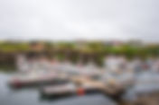
- Bakkafjörður hamlet in north east region
The tiny village of Bakkafjörður is probably the smallest hamlet in Iceland. It is a community in deface, as means of economic activity to support the village are few. It is isolated with respect to both activity and geography. It is more or less a cluster of houses, with an old small harbor fit for small boats. The population is approximately 60 individuals as of January 2022 and has remained relatively the same for over four decades. Every inhabitant’s livelihood depends on fishing and fish processing. A small cluster of houses in a remote place Bakkafjörður started to develop from a small trading post opened by Örum & Wulff in the late nineteenth century, in an era when it was profitable to have a store, as it may seem today, in the middle of nowhere. At that point in time, Bakkafjörður grew to a surprising number of more than 300 inhabitants in the third decade of the 20th century. In comparison to many other villages in the east and northeast, it is interesting to try to deduce why it didn’t have similar growth. One reason might be that the geographical location is not attractive, and the hamlet has almost no protection from the winds and harsh weather from the mountains. Today, Bakkafjörður is part of a larger municipality As part of the Langanesbyggð municipality after merging with Þórshöfn in 2006, most of the service provided to the residents is in Þórshöfn, approximately 40 kilometers north of the village. As a result, it is a significant task to purchase basic food and necessities. The same goes for healthcare. Almost the only service provided to the village residents locally is a primary and secondary school which currently has less than 15 pupils. Bakkafjörður has a small camping site, but with its limitation and bare exposure to winds, it is a question of how many tourists it can attract. Fishing also in decline Most of Bakkafjörður’s boats are small family-owned motorboats operated by one or two persons. Up until the end of December 2015, one company employed 13 people in the village. That December, the company Toppfiskur discontinued its operation and laid everyone off, which was understandably a huge blow and setback to this tiny village. The village consists mainly of a few single-family houses, a school, and a few buildings related to the fishing industry. Although small and isolated today, it is easily accessible as a part of Melrakkaslétta peninsula, which few tourists find a reason to visit. If you're planning to tour Iceland in a rental car , make sure to read this article about the three important things you need to know and the type of car that would be best for your trip!
- How to hike to the volcanic activity in Geldingadalir at Reykjanes Peninsula in Iceland
On the evening of March 19th, an eruption began on the Reykjanes Peninsula. It was not a surprise as thousands of earthquakes had shaken that region for more than a year. An indication that an eruption could be expected. As is common in Iceland, an eruption begins with a fissure on the surface, and glowing magma begins to float around the region. The fissure can extend for many kilometers, as it extended up to 27 kilometers in Skaftáreldar in 1783. In a matter of days, the magma starts to deliver a constant lava flow through a few craters that form randomly on the fissure. Conveniently, on March 19th, the fissure in Geldingadalir on the Reykjanes Peninsula was only about 500 meters. In a few hours, the immediate delivery of magma concentrated on one crater. At that point, it became clear that this small eruption would most likely turn into a tourist attraction. Rushing towards the eruption Unlike many people who would flee an eruption, Icelanders feel compelled to rush to the site when an eruption begins. Everyone wants to see this spectacular sight. It is not a mystery, as an eruption is one of the most magnificent things one can witness in his lifetime. It is stunning and breathtaking, far beyond the comparison that it is something out of a movie. It is the real deal, and standing so close that you can feel the heat from the magma gushing from the crater and flowing in rivers of fire makes your heart skip a beat. You can almost shake hands with the most powerful natural forces on the planet, and you are just a few kilometers from Reykjavík, the capital of Iceland, and the most populated on our small island. What kind of eruption – a message from the mantle Most eruptions in Iceland are from the basalt family, and this is also the case at Geldingadalir. The exciting thing about this eruption is that the magma seems to originate deep beneath the crust. The magma from the mantle is at least 20 kilometers beneath the surface. According to geologists, this hasn’t happened in thousands of years, as most Reykjanes eruptions have fed on magma chambers within the crust. It seems that the mantle has found a firetube through the crust straight to the surface. This is what we have learned from the chemical composition of the magma. This defines the eruption as a caldera rather than a crater and could indicate that this small and steady lava flow could last for years, decades, and even centuries. Eventually, the lava would pile up and float towards the ocean on the south shore of the Reykjanes Peninsula. Before hiking to Geldingadalir valley, there are crucial things to consider Thousands of Icelanders have hiked to the Geldingadalir valley to see and experience the eruption. It is not a difficult walk, but it requires careful planning and an understanding of the danger. As is customary in Iceland, you begin with the weather. The best weather is a light southerly wind and a clear sky, with a 7 to 34 mph wind speed. The wind will then blow the toxic chemicals north, preferably in your direction. Understanding and researching the chemicals delivered by magma is crucial and can be found on the Met Official website. It is also important to understand the nature of these toxic chemicals and how and where they settle. The safest place is usually upon the caldera hills, and it is best not to get too close to the valley. Some of the most toxic chemicals are invisible and do not warn that you are about to collapse. So be extremely cautious near the site and never walk into the volcano's smoke. The regular but important hiking matters you need to prepare for As shown on the map, the hike starts at road nr. 427 (Suðurstrandarvegur) and is around 2.2 miles to the volcanic activity. The hike back and forth should be a little less than 6.2 miles if you include a stroll on the hills' safe side. Although not a long or difficult hike in any way, it is in an area that is somewhat unpredictable in terms of weather and necessitates the preparation and gear required for any serious hike. First and foremost, good hiking shoes are required due to the harsh terrain. You also need warm clothing and a rain-resistant jacket and pants as a top layer. It is also good to have a small package of bandaid in your backpack. Water is another significant thing to carry. Remember to start with a full bottle of water. You also need to carry food for the day, like a sandwich, nuts, fruits, chocolate, and vegetables. For all this, you need a good backpack. For safety, a GPS and a fully charged phone You do not want to get lost in this area. That is why GPS or a tracking app is essential for this hike. You might find it unnecessary on a good day but remember the weather can change quickly and unexpectedly. It is also good to fully charge the phone before you start and carry it in the inner pocket to preserve the battery from getting drained due to cold. It is also good to carry a power bank if you intend to take many photos with your phone. And last but not least, you should bring a camera. Photographing the caldera/volcano I would bring a 14 to 24 mm lens and a 70 to 200 mm lens to take photos. For landscape photography, now is the time to use a telephoto lens. With those two lenses, you can cover all the angles you need at the location, and you can click magnificent photos from the hills around the caldera, even a closeup to the source of the floating lava. There are also out-of-this-world and jaw-dropping stuff to photograph in the lava, such as the river of fire, freshly solidified magma, splashing magma, and the overall formation of the lava with its many red fire lines and fire holes. I could probably go on and on. A hike that doesn’t come without danger Finally, I must emphasize that, while this is a once-in-a-lifetime opportunity for most people, it is not without risk. However, with proper planning and caution, you can reduce the risk. On the other hand, it is most likely one of the most incredible sights you will ever lay your eyes on. If you're planning to tour Iceland in a rental car, make sure to read this article about the type of car that would be best for your trip.